 Atlas of China
Yanbian 延边Yánbiān
Korean villages, Yanji cold noodles and the north slope of Changbai Mountain
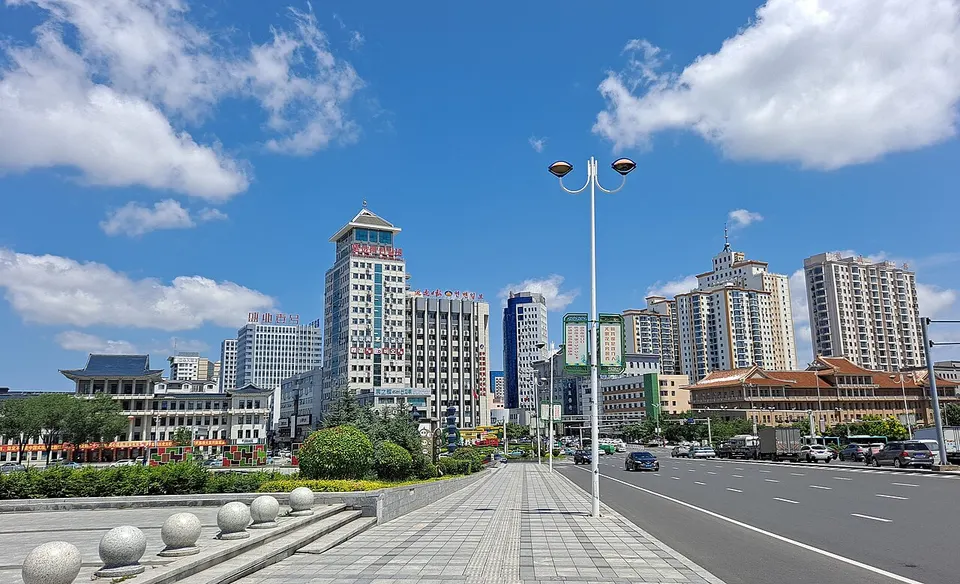
- Type
- Korean Autonomous Prefecture
- Region
- Jilin
- Seat
- Yanji
- Featured places
- 1
- Listed sites
- 271 rated 5A · 21 rated 4A · 7 national heritage
About Yanbian
Yanbian is China's only Korean autonomous prefecture, and about a third of its people are ethnic Korean, with their own villages, dress and food around the capital, Yanji. From Erdaobaihe, roads climb Changbai Mountain's north slope to Heaven Lake, the crater lake on the North Korean border, and the Tumen River runs to Fangchuan, where a tower overlooks the meeting point of China, Russia and North Korea. The Bohai kingdom was founded at Dunhua in 698; its royal tombs at Liudingshan can be visited.
What to eat in Yanbian
- Yanji cold noodles (延吉冷面)
Featured places in Yanbian
-

Changbai Mountain & Heaven Lake 长白山天池
A volcanic crater lake on the China–North Korea border, often wrapped in cloud
Listed sites in Yanbian
27 sites in Yanbian are on the official lists. Those with a page of their own link to it; the rest open as cards on the map.
- Liudingshan Cultural Tourism Area 六鼎山 5A scenic area · National heritage site
Liudingshan is a large cultural tourism area on the southern edge of Dunhua, laid out around a lake. - Baihuagu Korean Folk Village 长白山百花谷朝鲜族古村落 4A scenic area · on the map
Baihuagu is a village of traditional-style ethnic Korean (Chaoxian) houses built in the late 2010s on the road to Changbai Mountain, in Songjiang town, Antu county. - Changbai Mountain Canyon Floating Stone Forest 长白山峡谷浮石林 4A scenic area · on the map
A canyon about 5 km long and up to 40 m deep, cut into volcanic ground near the north side of Changbai Mountain, where weathering has left some 30 formations of pumice, a porous volcanic rock light enough to float. - Changbai Mountain History and Culture Park 长白山历史文化园 4A scenic area · on the map
A themed cultural park beside the road to Changbai Mountain in Sihe village, Songjiang town, laid out as 'four gardens and one zone' and presenting Confucian, Buddhist and Daoist themes. - Daguandong Culture Park 大关东文化园 4A scenic area · on the map
Daguandong Culture Park is a forest park in Dongqing village, Antu county, founded in 2013 and themed on Manchu customs and the 'Guandong' frontier culture of north-east China. - Daxitaihe Scenic Area 大戏台河 4A scenic area · on the map
Daxitaihe is a forest and river-valley scenic area run from the Huangsongpu forestry station of the Changbai Mountain forestry group, on the way to the north gate of Changbai Mountain. - Erdaobaihe 二道白河名镇 4A scenic area
Erdaobaihe is the gateway town on the north side of Changbai Mountain and an important base for visitors going up from this side; its centre was approved as a 4A scenic area in January 2019. - Fangchuan Scenic Area 防川 4A scenic area · National heritage site
Fangchuan is a small village on the lower Tumen River at the eastern tip of Hunchun, close to where the borders of China, Russia and North Korea meet. - Hancongling Scenic Area 寒葱岭 4A scenic area · on the map
Hancongling is a forested ridge in Dunhua's forestry district where units of the Northeast Anti-Japanese United Army under commanders including Yang Jingyu, Wei Zhengmin, Wang Detai and Chen Hanzhang fought and lived during the Anti-Japanese War. - Haoji Cultural Tourism Resort 好记文化旅游度假区 4A scenic area · on the map
Haoji Cultural Tourism Resort is a 720,000 m² complex of antique-style buildings in Wangqing County, built around the Haoji soy sauce factory. - Hongshifeng Scenic Area 红石峰 4A scenic area · on the map
Hongshifeng is a forested area at the Hongshi forestry station east of Erdaobaihe, with old forest and unusual rock outcrops. - Laobaishan Primeval Forest Scenic Area 老白山 4A scenic area · on the map
A forest tourism area developed by a state forestry company on former logging land in the Huangnihe district of Dunhua. - Liangtian Baishi Holiday Park 良田百世 4A scenic area · on the map
Liangtian Baishi is a leisure and holiday park on the bank of the Hailan River in Dongshengyong town, Longjing, planned as the main tourism area of the Yanji–Longjing–Tumen new district and receiving visitors since 2022. - Mengdumei Folk Resort and Ski Area 梦都美民俗旅游度假村 4A scenic area · on the map
Mengdumei is a holiday resort in Chunxing village, Yilan town, on the north side of Yanji, whose main draw is its ski area. - Mojie Scenic Area 长白山魔界 4A scenic area · on the map
Mojie ('Demon Realm') is a forest and wetland scenic area of about 88 ha near Erdaobaihe, on the north slope of Changbai Mountain. - Piyanshan Cultural Tourism Scenic Area 琵岩山 4A scenic area · on the map
Piyanshan is a hill beside Longjing from which visitors look over the Hailan River valley and the prefecture's largest apple-pear orchard, which flowers in spring. - Piyanshan Hot Spring Village 琵岩山温泉古村落 4A scenic area · on the map
Piyanshan Hot Spring Village is a hot-spring resort built in traditional Korean style, with white walls, dark roof tiles, timber galleries and stone-paved lanes, next to Piyan Mountain near Longjing. - Qinglong Fishery Park 青龙渔业 4A scenic area · on the map
Qinglong Fishery Park is a spring-fed cold-water fish farm turned leisure resort at Qinglong village, Toudao town, in Helong. - Xueshan Feihu (Snow Mountain Lake) 雪山飞湖 4A scenic area · on the map
Xueshan Feihu, also called Snow Mountain Lake, is a reservoir on the upper Second Songhua River in Liangjiang town, surrounded by forest and cliffs, with many small peninsulas and rock formations the county names Banana Rock and Sun Rock. - Yaguang Lake National Wetland Park 亚光湖国家湿地公园 4A scenic area · on the map
A reservoir and wetland park in the hills of Dashitou town, Dunhua, about 6.2 km from north to south and 5.5 km from east to west and covering 2,291 ha of forest, lake, hills, wetland and grassland. - Yanbian Museum 延边博物馆 4A scenic area
Yanbian Museum is the main museum of Yanbian Korean Autonomous Prefecture, a national second-class museum with about 15,000 items, in a new building opened in 2012 on a site of more than 20,000 m² on Changbai West Road. - Yanji Maoershan Dinosaur Culture Tourism Area 延吉帽儿山恐龙文化旅游区 4A scenic area · on the map
This tourist area of about 1.8 km² on the southern side of Yanji combines dinosaur-themed attractions, the woodland of Maoershan hill and a folk and commercial quarter. - Ancient Tombs at Longtou Mountain 龙头山古墓群 National heritage site · on the map
A cemetery of the Bohai kingdom on the east side of Longtou Mountain in Toudao town, where more than ten tombs in three burial zones have been found since 1980. - Baliancheng, Bohai Eastern Capital Site 八连城遗址 National heritage site · on the map
Baliancheng is the site of Dongjing Longyuanfu, the 'Eastern Capital' of the Bohai kingdom, founded around 785 and abandoned about 928. - Bohai Zhongjing Site (Xigucheng) 渤海中京城遗址 National heritage site
Xigucheng is the site of Zhongjing, the 'Middle Capital' of the Bohai kingdom (698–926), a city built around 742 in what is now Helong. - Changbai Mountain Temple Site (Baomacheng) 长白山神庙遗址 National heritage site · on the map
The Changbai Mountain Temple site, long known locally as Baomacheng, is the remains of a Jin-dynasty (1115–1234) imperial temple on a raised terrace in the forest north-west of Erdaobaihe, where the court made sacrifices to Changbai Mountain. - Former Yanji Border Affairs Bureau 延吉边务督办公署旧址 National heritage site · on the map
A Qing government office building of the frontier affairs commission that was set up in Yanji in 1907 and headed by the commissioner Wu Luzhen; it is nicknamed the 'garrison tower' and the 'daoyin building'.
Getting to Yanbian
Train, flight and driving times from the cities most visitors come from, with stations, fares and how many run a day; each opens the full comparison.
On the map
Open Yanbian on the illustrated map to see its outline, its places and listed sites together, and to add them to a trip.
Open Yanbian on the map