 Atlas of China
Baise 百色Bǎisè
Sinkholes 600 metres deep in the Zhuang karst of Guangxi's far west
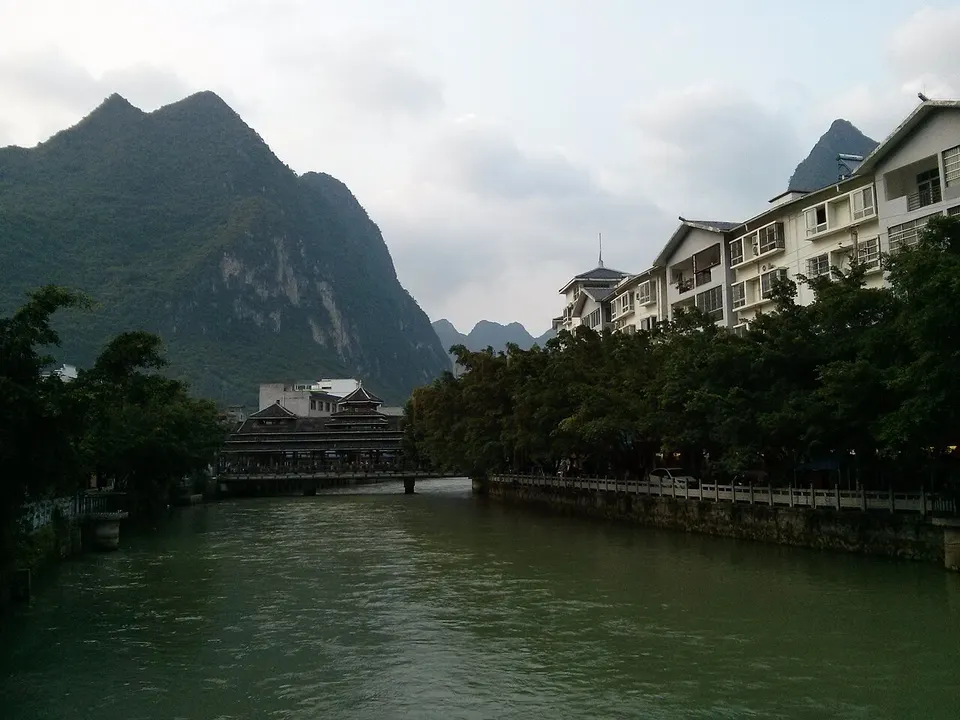
About Baise
Guangxi's largest and westernmost prefecture climbs from the hot Youjiang valley, known for its mangoes, onto the edge of the Yunnan–Guizhou Plateau, along the border with Vietnam, and three in four people are Zhuang. In Leye, the Dashiwei Tiankeng drops 613 metres to virgin forest, part of a UNESCO Global Geopark since 2010. Stone hand axes from the Bose Basin are about 800,000 years old, and Baise is best known in China for the 1929 Baise Uprising, led by Deng Xiaoping.
What to eat in Baise
- Lingyun Baihao tea (凌云白毫茶)
Listed sites in Baise
23 sites in Baise are on the official lists. Those with a page of their own link to it; the rest open as cards on the map.
- Baise Uprising Memorial Park 百色起义纪念园 5A scenic area · National heritage site
A memorial park on Yinglong, Panlong and Houlong hills on the east side of Baise, set up in 2008 around the sites of the Baise Uprising of 11 December 1929, in which Communist forces led by Deng Xiaoping, Zhang Yunyi and Wei Baqun founded the Seventh Red Army. - Baise Happy Town 百色欢乐小镇 4A scenic area · on the map
A leisure complex south-east of Baise built around the Xinghe water park, with other family attractions and a street of restaurants and shops. - Cen Family Buildings (Gongbao Mansion), Xilin 宫保府 4A scenic area · National heritage site
The hillside compound of the Cen family above the Tuoniang River at Nalao, home of the Qing official Cen Yuying, Viceroy of Yunnan and Guizhou, and his son Cen Chunxuan. - Dashiwei Tiankeng (Leye Sinkholes) 大石围天坑群 4A scenic area · on the map
The largest of about 30 collapse sinkholes around Leye: Dashiwei is about 613 m deep, 600 m long and 420 m wide, with an underground river and a primeval forest of about 9.6 hectares growing on its floor. - Dawangling Scenic Area 大王岭 4A scenic area · on the map
A forest scenic area in the heart of the Dawangling nature reserve, known for its well-preserved old-growth forest, groves of tree ferns and river rafting. - Debao Pony Kingdom 德保矮马王国 4A scenic area · on the map
A family theme park built around the Debao pony, the county's small local horse breed, opened in 2020 at the exit of Jixingyan Cave. - Equan Spring 鹅泉 4A scenic area · on the map
A large karst spring 6 km south of Jingxi city, welling up from an underground river into a clear pool among rice fields and limestone peaks; its waters flow on towards Detian Waterfall. - Fangshan Cultural Park, Debao 芳山文化园 4A scenic area · on the map
A riverside park of about 17 hectares in the centre of Debao town, joining Fangshan hill and the former Jiuqu Bridge park along the Jian River. - Ganzhuang Mountain (Buluotuo Site) 敢壮山 4A scenic area · on the map
A hill near Baiyu revered by the Zhuang as the home of Baeuqloxdoh (Buluotuo), the creator god and first ancestor in Zhuang mythology. - Gulongshan Grand Canyon 古龙山大峡谷 4A scenic area · on the map
A 7.8 km chain of four gorges joined by three underground-river caves in Huru town near the Vietnamese border, best known for a rafting run that passes through gorges and caves in turn. - Haokun Lake 浩坤湖 4A scenic area · on the map
A clear green lake in the karst hills of southern Lingyun County, ringed by limestone peaks, with small islands and lone peaks rising from the water. - Jinxiu Ancient Town, Jingxi 锦绣古镇 4A scenic area · on the map
A shopping and dining district on the east side of Jingxi city, built in old-town style around Zhuang and border-culture themes, with a commercial street, a night-market food street, themed inns and waterside restaurants. - Jiuzhou Old Town, Jingxi 旧州 4A scenic area · on the map
A Zhuang town south of Jingxi, once home to the local chieftain family, known for its hand-made embroidered balls (xiuqiu), which hang along the main street; visitors can learn to cut and stitch one in the workshops. - Jixingyan Cave 吉星岩 4A scenic area · on the map
A four-level limestone cave 13 km south of Debao town, of which the second level is open on a route of about 2 km through five halls. - Longyunshan Tea Town, Leye 龙云山故事小镇 4A scenic area · on the map
A mountain resort built around a 3,000-mu (about 200-hectare) organic tea plantation in Gantian township, about 20 km from Leye town. - Red Leaf Forest Park, Debao 红叶森林公园 4A scenic area · on the map
A forest park just north-east of Debao town, planned to cover about 1,000 hectares, whose sweetgum trees turn red, crimson and yellow in autumn around Hongfeng Lake, the Red Leaf Valley and two reservoirs. - Tiandong Wetland Park 田东湿地公园 4A scenic area · on the map
A town park on the western side of Pingma, Tiandong's county seat, laid out around lakes beside the Baigu River. - Tianzhou Old Town 田州古城 4A scenic area · on the map
A Zhuang-themed town built in traditional style in Tianyang and opened in 2014, covering about 100 hectares with canals, a Buluotuo square, an ancestral pagoda, watchtowers, a Zhuang history museum and streets of shops, restaurants, inns and bars. - Tongling Grand Canyon 通灵大峡谷 4A scenic area
A deep, forest-filled gorge in Huru town near the Vietnamese border, entered by a path that drops through old trees into a cave about 100 m high and on to Tongling Falls, a single 188.6 m drop into a pool fed by an underground river. - Tongtian River Cave 通天河 4A scenic area · on the map
A show cave with an underground river in Liming township, formerly called Ganmo Cave: a 1.68 km walk through large chambers with more than twenty columns over 20 m tall is followed by a 1.6 km boat ride on the underground river, about 1.5 hours in all. - Zhen'an Park and Gantuo Cave Site, Napo 镇安公园·感驮岩 4A scenic area · National heritage site · on the map
A town park at the foot of Houlong Hill on the north side of Napo, around Gantuo Cave, where excavations in 1997–2000 found burials and more than a thousand pottery, stone, bone, shell and iron objects from the late Neolithic to the Iron Age, including a ritual zhang blade, the first found in Guangxi. - Former Site of the Youjiang Workers' and Peasants' Democratic Government 右江工农民主政府旧址 National heritage site · on the map
The Jingzheng Academy, a Qing-dynasty school founded by local gentry in Pingma, Tiandong's county town, which became the seat of the Youjiang Workers' and Peasants' Democratic Government set up after the Baise Uprising of 1929. - Site of the Xilin Incident 西林教案发生地 National heritage site
A restored old building and stone-paved courtyard on Dongxin Street in Ding'an, which was the seat of Xilin County in the 1850s.
On the map
Open Baise on the illustrated map to see its outline, its places and listed sites together, and to add them to a trip.
Open Baise on the map