 Atlas of China
Bayingolin 巴音郭楞Bāyīnguōlèng
Swan wetlands, Xinjiang's largest lake and the ruins of the Lop desert
- Type
- Mongol Autonomous Prefecture
- Region
- Xinjiang
- Seat
- Korla
- Listed sites
- 172 rated 5A · 12 rated 4A · 7 national heritage
About Bayingolin
Bayingolin is China's largest prefecture-level division, about a quarter of Xinjiang, reaching from the Tian Shan across the Tarim Basin to the Kunlun and Altun mountains. Mongol herders graze the high Bayanbulak grassland, where the Kaidu River meanders through swan wetlands before feeding Bosten Lake, Xinjiang's largest lake. Farther south lie the Buddhist ruins of Shikshin and Miran, while the ancient city of Loulan in the Lop Nur desert is closed to tourists.
Listed sites in Bayingolin
17 sites in Bayingolin are on the official lists. Those with a page of their own link to it; the rest open as cards on the map.
- Bayanbulak Grassland 巴音布鲁克 5A scenic area
A high grassland basin in the central Tian Shan at about 2,000–2,500 m, home mainly to Mongol herders, where the Kaidu River meanders through marshes and oxbow lakes. - Bosten Lake 博斯腾湖 5A scenic area
Bosten is Xinjiang's largest lake, a freshwater lake of more than 1,000 km² lying at about 1,048 m in the Yanqi Basin on the south side of the Tian Shan. - Baluntai Yellow Temple 巴仑台黄庙 4A scenic area · National heritage site · on the map
A Gelug (Tibetan Buddhist) monastery founded in 1888 by the Torghut Mongol khans in a Tian Shan valley at Baluntai, given the name Yong'an Temple by the Guangxu emperor and long the chief religious centre of the Torghut and Khoshut Mongols. - Bayingolin Prefecture Museum 巴州博物馆 4A scenic area · on the map
The prefecture museum of Bayingolin in Korla, founded in 1990 and opened in 2008, and rated a national second-grade museum in 2018. - Beishan Forest Park, Hejing 北山森林公园 4A scenic area · on the map
A forest park on formerly bare gobi hills at the north-western edge of Hejing town, where gravel quarries were moved out from 2013 and more than 50 kinds of trees and shrubs, among them desert poplar, oleaster, sea buckthorn and walnut, were planted on drip irrigation fed from the Huangshui gully. - Golden Sand Beach, Bosten Lake 金沙滩 4A scenic area · on the map
A sand-beach resort on the north-eastern shore of Bosten Lake in Hoxud County, upgraded in 2024–25 with a visitor centre, lakeside promenade, jetty, hotels and guesthouses. - Gongnaisi Forest Park 巩乃斯森林公园 4A scenic area · on the map
A forest park in the Gongnaisi (Künes) valleys of the Tian Shan in north-western Hejing County, at an average altitude of about 2,000 m, where the main valley runs for some 40 km. - Horashan Silk Road Village 霍拉山丝路古村 4A scenic area · National heritage site · on the map
A farming village on the southern slope of the Horashan range west of Yanqi, developed as a rural tourism area and rated 4A in 2018, with a horse-culture hall, a market street built in the style of ancient Yanqi, farm restaurants, guesthouses and a visitor centre. - Kaidu River Scenic Area, Bohu 开都河景区 4A scenic area · on the map
Riverside parkland along the Kaidu River at Bohu town, rated 4A in 2022, with walks, Tianhuwan Square and the 182 m Qinbo Bridge, whose glass-floored deck is lit with coloured lights and music in the evening. - Loplik Village 罗布人村寨 4A scenic area · on the map
A tourist village on the banks of the Tarim River in Yuli County that presents the culture of the Lop people (Lopliks) of the lower Tarim, relaunched in 2025 after a major upgrade. - Miran 米兰古城 4A scenic area · National heritage site
The ruins of a Silk Road oasis town where the Lop desert meets the Altun Mountains, once part of the Shanshan (Loulan) kingdom, with a large rectangular fort built under Tibetan rule in the 8th–9th centuries, Buddhist temple and stupa ruins and traces of an ancient irrigation system. - Shikshin Temple 七个星佛寺遗址 4A scenic area · National heritage site
The largest Buddhist site of the ancient kingdom of Karasahr (Yanqi), founded in the Jin period and abandoned only when Islam reached the area around the 15th century. - Swan River, Korla 天鹅河 4A scenic area · on the map
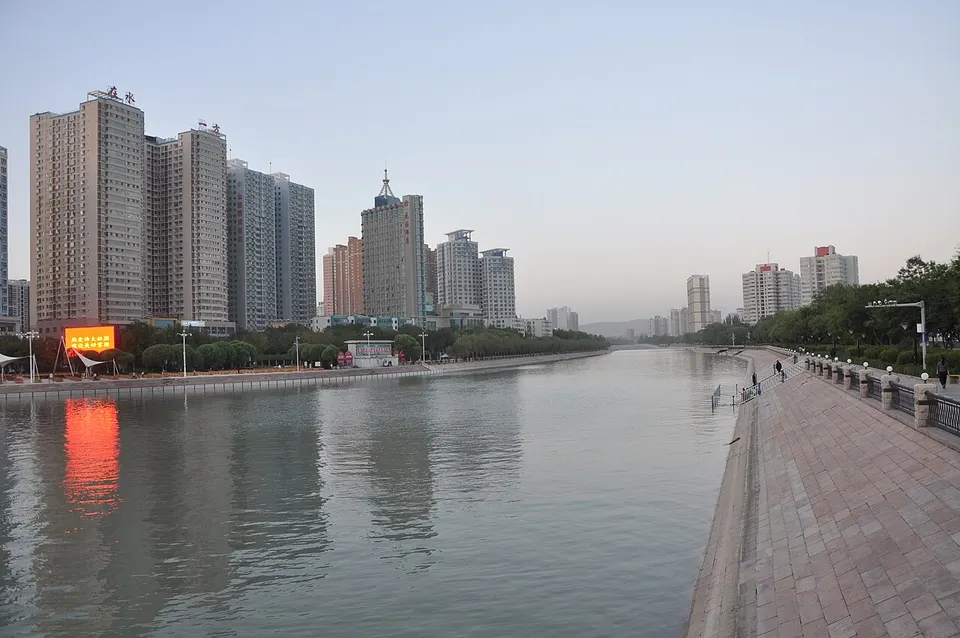
A landscaped river corridor in Korla's newer districts, near Minsheng Bridge, with riverside walks, summer lotus beds and boat rides. - Tarim Desert Poplar Forest Park 塔里木胡杨林公园 4A scenic area · on the map
A forest park of about 100 km² on the middle Tarim River in Luntai County, set in natural desert-poplar (Populus euphratica) forest on the northern edge of the Taklamakan. - Bogedaqin Ancient City 博格达沁古城 National heritage site · on the map
The rammed-earth walls of the largest Han-to-Tang city site in Bayingolin, a rectangular enclosure with barbicans at its gates and traces of an outer moat. - Hongshan Nuclear Test Command Centre Site 红山核武器试爆指挥中心旧址 National heritage site · on the map
The former Hongshan headquarters area of Base 21, the Malan nuclear test base, which from 1966 housed the command centre and research institutes for China's nuclear tests at Lop Nur, and where scientists such as Deng Jiaxian lived and worked. - Manhan Khan's Palace 满汗王府 National heritage site · on the map
The palace of Manchuk Jab (Manhan), khan of the Old Torghut Mongols, built in 1919 in the centre of Hejing to a design by his uncle, the fifth Shengqin lama.
On the map
Open Bayingolin on the illustrated map to see its outline, its places and listed sites together, and to add them to a trip.
Open Bayingolin on the map