 Atlas of China
Baotou 包头Bāotóu
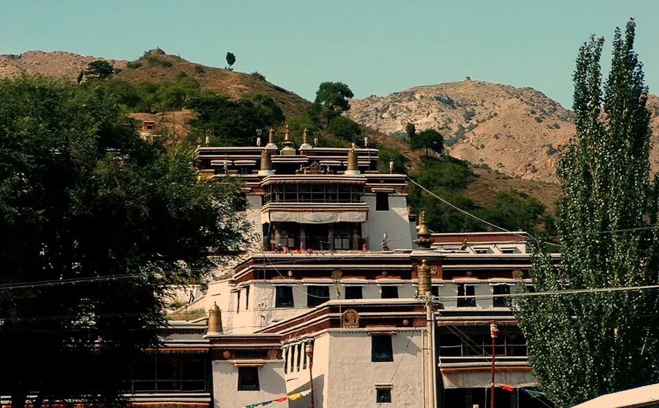
Steel works, a hillside Gelug monastery and an old stretch of Great Wall
- Type
- City
- Region
- Inner Mongolia
- Listed sites
- 1814 rated 4A · 6 national heritage
About Baotou
Baotou, from a Mongolian name meaning 'place with deer', is an iron-and-steel city on the north bank of the Yellow River, home to the Baogang works, whose first blast furnace tapped iron in 1959. In the hills of Shiguai District, Badekar Monastery (Wudangzhao), founded in the early 18th century, is the largest Tibetan Buddhist monastery in Inner Mongolia, and Meidaizhao began as a walled town built by Altan Khan. North of the city, the Qin Great Wall runs for about 120 km through Guyang County.
What to eat in Baotou
- Baotou old tea soup, a hot millet-flour drink poured from a long-spouted copper kettle (包头老茶汤)
Listed sites in Baotou
18 sites in Baotou are on the official lists. Those with a page of their own link to it; the rest open as cards on the map.
- Badekar Monastery (Wudangzhao) 五当召 4A scenic area · National heritage site
Badekar Monastery, known in Chinese as Wudangzhao, is a Gelug-school Tibetan Buddhist monastery in the hills of Shiguai District, founded in the early 18th century and enlarged from 1749. - Bailing Naadam Park 百灵那达慕园区 4A scenic area · on the map
Bailing Naadam Park is a purpose-built festival ground on the edge of Bailingmiao, with an oval racecourse, a main grandstand for about 11,000 people, six stables holding 360 horses and a sales area for local goods. - Baogang Industrial Tourism Area 包钢工业旅游区 4A scenic area · on the map
The tour area is run by the Baotou Iron and Steel (Baogang) group at its works in Kundulun District, one of the three large steel complexes begun in the 1950s. - Chilechuan Scenic Area, Tumed Right Banner 敕勒川风景区 4A scenic area · on the map
Chilechuan Scenic Area is a group of sights in Tumed Right Banner, covering about 16 square kilometres between the Daqing Mountains and the Yellow River. - Chunkunshan 春坤山 4A scenic area · on the map
Chunkunshan is a mountain area of about 30 square kilometres in Guyang County, the highest range in Baotou, with a main peak of 2,340 metres. - Huawu Renjian Garden Park 花舞人间 4A scenic area · on the map
Huawu Renjian is a commercial leisure park in the hills of the Xiguitu new district of Shiguai District, modelled on a park of the same name near Chengdu. - Jimusitai Scenic Area 吉穆斯泰 4A scenic area · on the map
Jimusitai, which Chinese sources render as Huaguoshan or 'Flower-and-Fruit Mountain', is a group of rocky hills with weathered stone formations in Damao Banner. - Meidaizhao Monastery 美岱召 4A scenic area · National heritage site
Meidaizhao is a walled monastery in Tumed Right Banner that began as a fortified town built by the Tumed Mongol leader Altan Khan in the 16th century and later became a Gelug-school Tibetan Buddhist temple. - Meilegen Scenic Area 梅力更 4A scenic area · on the map
Meilegen is a mountain valley on the south side of the Wula Mountains in Jiuyuan District, with a Gelug-school lamasery at its mouth and a stream, cypress woods and waterfalls further up; one waterfall drops about 60 metres. - Nanhai Wetland 南海湿地 4A scenic area · on the map
Nanhai Wetland lies on the north bank of the Yellow River at the southern edge of Baotou's Donghe District, a lake and floodplain wetland that formed after the river shifted south. - Northern Weapon City 北方兵器城 4A scenic area · on the map
Northern Weapon City is an open-air display of retired weapons set in a landscaped park with lakes in Baotou's Qingshan District, planned and set up by the Beizhong Group (Northern Heavy Industries), part of China North Industries Group. - Saihan Tala Urban Grassland 赛汗塔拉城中草原 4A scenic area · on the map
Saihan Tala is a large area of native grassland in the middle of Baotou, protected by a city regulation since 2007 and covering about 10,680 mu (roughly 7 square kilometres) as of 2020. - Shihua Grassland (Poetry and Painting Grassland) 诗画草原 4A scenic area · on the map
Shihua Grassland is a purpose-built tourist camp on open steppe in Damao Banner, made up of arcs of white ger-style buildings around landscaped plazas. - Silu Mengjun Grassland Tourism Area 丝路梦郡 4A scenic area · on the map
Silu Mengjun is a purpose-built tourist complex on the grassland near Xilamuren town in Damao Banner, laid out as a compound of ger-style buildings around central plazas. - Aolunsumu City Ruins 敖伦苏木城遗址 National heritage site · on the map
Aolunsumu, also written Olon Süme, is a ruined walled city in the steppe of Damao Banner, identified since the 1930s as a possible northern capital of the Ongud, a Turkic-speaking people allied to the Mongol rulers and prominent under the Yuan dynasty. - Kundulun Zhao (Faxi Temple) 昆都仑召 National heritage site · on the map
Kundulun Zhao, given the name Faxi Temple under the Qing, is a Gelug-school Tibetan Buddhist monastery in the foothills on the northern edge of Baotou's Kundulun District. - Machi Ancient City and Zhaowan Tombs 麻池城址和召湾墓群 National heritage site · on the map
Machi is the site of Jiuyuan, a frontier city founded by the state of Zhao in the Warring States period and kept as the seat of Jiuyuan Commandery under the Qin and of Wuyuan Commandery under the Han. - Qin Great Wall, Guyang 固阳秦长城遗址 National heritage site · on the map
This stretch of the Great Wall was built under the First Emperor of Qin more than 2,200 years ago and runs for about 120 km through the hills of Guyang County, north of Baotou, as a defence against the Xiongnu.
On the map
Open Baotou on the illustrated map to see its outline, its places and listed sites together, and to add them to a trip.
Open Baotou on the map