 Atlas of China
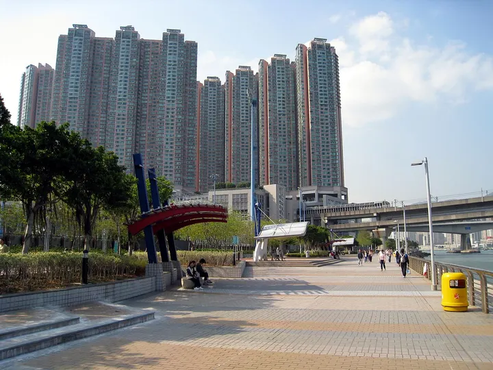
Tsing Yi Promenade 青衣海滨公园Qīngyī Hǎibīn Gōngyuán
Hong Kong, Hong Kong
- Time needed
- 1 hour
- Days to budget
- Half a day
- City
- Hong Kong
- Region
- Hong Kong
- Type
- City
About Tsing Yi Promenade
A 1.6 km waterfront walkway on the north-east coast of Tsing Yi, facing across Rambler Channel to Kwai Chung. To the south there are views of the Tsing Ma Bridge, the container port and the western end of Hong Kong Island. It is pleasant at sunrise and sunset, with locals jogging, cycling, practising tai chi and fishing along the shore.
How to get to Tsing Yi Promenade
About 0.3 km south-east of Tsing Yi MTR station, on Nga Ying Chau Street.
Nearby
- Victoria Harbour 维多利亚港 under 10 km
Glass towers and green hills around a harbour you can cross in ten minutes - Victoria Peak 太平山顶 10 km
Ride the 1888 funicular to the skyline view, then walk the Lugard Road loop - Tian Tan Buddha & Ngong Ping 天坛大佛与昂坪 20 km
A giant bronze Buddha on Lantau, reached by a 25-minute cable car ride - Historic Centre of Macau 澳门历史城区 60 km
Portuguese tiled squares, baroque churches and Chinese temples, a short walk apart
Also within 20 km: Old House, Hoi Pa Village 海坝村古屋 (under 10 km), The Mills 南丰纱厂 (under 10 km), Sam Tung Uk Museum 三栋屋博物馆 (under 10 km), Tsing Ma Bridge 青马大桥 (under 10 km), Historic Structures of Kowloon Reservoir 九龙水塘历史构筑物 (under 10 km), Memorial Stone of Shing Mun Reservoir 城门水塘纪念碑 (under 10 km).
On the map
Open Tsing Yi Promenade on the illustrated map to see the terrain around it and what else is close, and to add it to a trip.
Open Tsing Yi Promenade on the map