 Atlas of China
Haikou Chuanzi Sluice 海口川字闸Hǎikǒu Chuānzì Zhá
National heritage site · Kunming, Yunnan
- Time needed
- 30 minutes
- Days to budget
- Half a day
- City
- Kunming
- Region
- Yunnan
- Type
- Heritage
- Listed as
- National heritage site
About Haikou Chuanzi Sluice
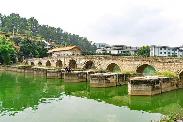
A combined sluice and multi-arched stone bridge built in 1836 at the outlet of Dian Lake, at Zhongtan village in Haikou. Its northern, central and southern sections span three parallel channels, a layout that recalls the three strokes of the Chinese character chuan and gives the sluice its name; it once served to hold back water, release floods, irrigate fields and carry traffic.
How to get to Haikou Chuanzi Sluice
In Haikou, about 35 km south-west of central Kunming, roughly an hour by road; the Shilongba hydropower station lies a short drive downstream.
Nearby
- Western Hills & Dragon Gate 西山龙门 20 km
Taoist grottoes and a single-file ledge path cut into a cliff high above Dianchi Lake - Green Lake Park 翠湖公园 30 km
Kunming's favourite park, where wintering gulls wheel over willow-lined causeways - Chengjiang Fossil Site & Fuxian Lake 澄江化石地与抚仙湖 40 km
Half-billion-year-old fossils of early animals beside one of China's deepest lakes
Also within 20 km: Shilongba Hydropower Station 石龙坝水电站 (10 km), Shizhaishan Archaeological Site Park 石寨山考古遗址公园 (10 km), Zheng He Park and Ma Haji Tomb Stele 马哈只墓碑 (10 km), Yulong Bay 玉龙湾 (10 km), Laoyuhe Wetland Park 捞鱼河湿地公园 (20 km), Anning Confucian Temple 安宁文庙 (20 km).
On the map
Open Haikou Chuanzi Sluice on the illustrated map to see the terrain around it and what else is close, and to add it to a trip.
Open Haikou Chuanzi Sluice on the map