 Atlas of China
Ganzi 甘孜Gānzī
Glaciers, holy peaks and monasteries across the high plateau of Kham
- Type
- Tibetan Autonomous Prefecture
- Region
- Sichuan
- Seat
- Kangding
- Featured places
- 5
- Listed sites
- 3727 rated 4A · 15 national heritage
About Ganzi
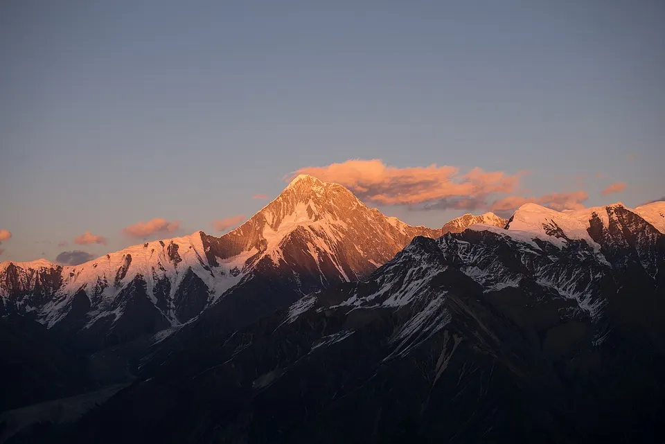
Ganzi, Garzê in Tibetan, spreads across the Kham region of the Tibetan Plateau, a vast, thinly peopled land where most people are Tibetan. Mount Gongga, Sichuan's highest peak at more than 7,500 metres, sends the Hailuogou Glacier down into fir forest, and Daocheng Yading guards three sacred snow peaks in the south. From Kangding, the gateway, roads lead on to the Tagong Grassland, the painted houses of Jiaju Tibetan Village and the Derge Parkhang, where scriptures are still printed by hand from woodblocks.
Featured places in Ganzi
-
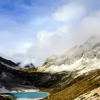
Daocheng Yading 稻城亚丁
Three sacred snow peaks, glacial lakes and Tibetan meadows high on the plateau
-
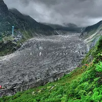
Hailuogou Glacier 海螺沟
A glacier spilling down into fir forest beneath Mount Gongga, Sichuan's highest peak
-
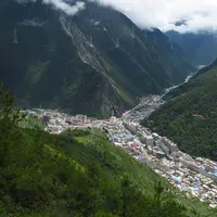
Kangding 康定
An old tea-trading town where Tibetan and Han cultures meet, made famous by a love song
-
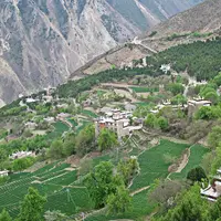
Jiaju Tibetan Village 甲居藏寨
Painted Gyalrong Tibetan farmhouses on a mountainside, in a valley of ancient towers
-
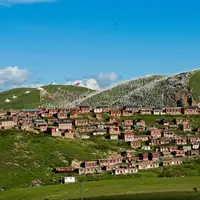
Tagong Grassland 塔公草原
Yak pastures, a revered monastery and the snow peak of Zhara Lhatse on the horizon
Listed sites in Ganzi
37 sites in Ganzi are on the official lists. Those with a page of their own link to it; the rest open as cards on the map.
- 18th Army Cave Dwellings, Ganzi 十八军窑洞群遗址 4A scenic area · on the map
In 1951, soldiers of the People's Liberation Army's 18th Army dug cave dwellings into a hillside about 4 km from Ganzi town while building Ganzi airfield, in support of the army's march into Tibet. - Bage Mani Wall 巴格嘛呢墙 4A scenic area · National heritage site · on the map
The Bage Mani Wall is a long wall built entirely of stones carved with Buddhist mantras and images, running across the grassland of Shiqu County. - Chachenggou Hot Springs, Xiangcheng 查呈沟天浴温泉 4A scenic area · on the map
A valley at Kemai village in Ranwu township, Xiangcheng County, where the county counts 108 hot springs between 17°C and 85°C within half a square kilometre. - Dengma Wetland Park 邓玛湿地公园 4A scenic area · on the map
Dengma Wetland Park takes in riverside wetland around Zhengke and Luoxu in the Jinsha River valley of southern Shiqu County, on the border with Tibet. - Derge Parkhang 德格印经院 4A scenic area · National heritage site
The Derge Parkhang is a working Tibetan printing house founded in 1729 by Tenpa Tsering, king of Derge, and attached to the Sakya-school Gonchen Monastery. - Duoraogamu Cultural Park, Tagong 多饶嘎目 4A scenic area · on the map
A cultural park below Mount Zhara (Yala) near Tagong, rated 4A in February 2025 and built around the Minyak Tibetan culture of the area. - Fudi Serthar Cultural Area (former Waxu Tribe area), Luoruo 福地色达 4A scenic area · on the map
A 4A cultural area listed at Luoruo, the township in the Larung valley of Serthar County, which until recently went by the name Waxu Tribe Cultural Tourism Area. - Gesar King City, Garzê 格萨尔王城 4A scenic area · on the map
A newly built cultural complex on the south-eastern edge of Garzê county town, begun in 2017, opened in 2019 and themed on King Gesar, hero of the Tibetan epic, with zones for Gesar culture, the epic, grassland and wetland. - Gsumge Mani Stone Castle 松格嘛呢石经城 4A scenic area · National heritage site · on the map
The Gsumge (Songge) Mani Stone Castle is a rectangular mass of stacked mani stones, carved with mantras and Buddhist images, about 73 by 47 metres and 9 metres high, rising to 15 metres, on the Zachuka grassland of Shiqu County. - Huiyuan Temple (Gata) 惠远寺 4A scenic area · National heritage site
Huiyuan Temple was founded in 1728 on the orders of the Qing Yongzheng Emperor in the Gata valley north of Bamei, and the 7th Dalai Lama lived here for seven years before returning to Tibet; the 11th Dalai Lama was born in a nearby village in 1838. - Kangba Hanzi Village, Yajiang 康巴汉子村 4A scenic area · on the map
A Tibetan village on the G318 at Xi'eluo, formerly called Jiezhu, which registered the name 'Kangba Hanzi' (men of Kham) as a trademark in 2005 and turned to tourism; it became a 4A area in 2022. - Kangba Wendu Cultural Park 康巴文都 4A scenic area · on the map
Kangba Wendu is a large, newly built culture park beside Dêgê town presenting the crafts and traditions for which Dêgê is known across Kham. - Kasa Lake (Liangquhe Scenic Area) 卡萨湖 4A scenic area · on the map
Kasa Lake is a freshwater plateau lake at roughly 3,510 metres, set among grassland and hills just off the G317, the northern Sichuan–Tibet highway, in western Luhuo County. - Lalong Tso Wetland 拉龙措 4A scenic area · on the map
Lalong Tso is a national wetland park high on the plateau of eastern Baiyu County, where moraine-dammed lakes lie among glacier-polished rocks and boulders left by ancient glaciers. - Litang Old Town 勒通古镇 4A scenic area · on the map
Litang's old quarter, on the north side of this high-plateau town at about 4,000 metres, covers roughly 1.5 square kilometres: some 4,000 Tibetan houses in 13 old villages, many still lived in by local families. - Luding Bridge 泸定桥 4A scenic area · National heritage site
Luding Bridge is an iron-chain suspension bridge spanning about 100 metres across the Dadu River in Luding town, built in 1705–1706 on the orders of the Kangxi Emperor as a key crossing on the road between Sichuan and Tibet. - Minyak Holy Land, Kangding 木雅圣地 4A scenic area · on the map
A tourist area west of Zheduo Pass in Kangding, presented as the first themed area devoted to the culture of the Minyak (Muya) Tibetans, in an area that was once a checkpoint on the tea-horse road. - Moshi Park 墨石公园 4A scenic area · on the map
Moshi ('ink stone') Park is a forest of dark grey rock pinnacles near Bamei in Daofu County, standing out against the surrounding grassland. - Mugecuo Lake 木格措 4A scenic area
Mugecuo is an alpine lake at about 3,780 metres in the mountains north-west of Kangding, nearly 3 km long and fringed by forest, grassland and snow peaks. - Qingde White Tibetan Villages 青德藏乡田园 4A scenic area · on the map
Around Qingde, just south of Xiangcheng town, villages of whitewashed rammed-earth Tibetan houses stand among terraced barley fields in the valley. - Sangdui Red Grass Wetland 桑堆红草湿地 4A scenic area · on the map
In the river valley at Sangdui, north of Daocheng, shallow pools are filled with an aquatic grass that turns deep red in autumn. - Tsopu Valley 措普沟 4A scenic area · on the map
Tsopu is a high valley in northern Batang County whose sacred lake, Tsopu Lake, lies backed by snow peaks and forest. - Wuxu Lake 伍须海 4A scenic area · on the map
Wuxu Lake is a clear green barrier lake set among mountains about 25 km from Jiulong town, within the Mount Gongga national scenic area. - Xinlong Red Mountains 新龙红山 4A scenic area · on the map
The Red Mountains lie in Yinduo township in the north-west of Xinlong County. - Xinluhai (Yilhun Lha Tso) 新路海 4A scenic area
Xinluhai, Yilhun Lha Tso in Tibetan and officially Yulong Latso, is a glacial lake at about 4,020 metres at the foot of Chola Mountain, about 3 km long and dammed by glacial moraine; it is described as the largest lake of its kind in China. - Yala Snow Mountain, Daofu 亚拉雪山 4A scenic area · on the map
Yala (Zhara Lhatse), the 5,820-metre sacred peak that dominates the Tagong grassland, also rises above Daofu County to the north, and this scenic area covers that northern side. - Zangbala Flower Fields, Litang 藏巴拉花海 4A scenic area · on the map
A flower-field and farm area at Hange village in Zhuosang township, south of Litang, beside the G227 road and next to the Haizishan nature reserve. - Beri Monastery 白利寺 National heritage site
Beri Monastery stands on a hillside above the north bank of the Yalong River about 10 km west of Ganzi town, and its present buildings date from the Qing dynasty. - Bori Bridge 波日桥 National heritage site · on the map
Bori Bridge is a wooden cantilever bridge across the Yalong River in Xinlong County, 125 metres long with a 60-metre span, the longest-spanning bridge of its kind surviving in the Tibetan areas. - Dadu River Suspension Bridge, Luding 大渡河悬索桥 National heritage site · on the map
A steel suspension bridge 132 metres long across the Dadu River, about 900 metres upstream of the old Luding chain bridge, built between November 1950 and the end of May 1951 by highway engineers, army engineering troops and local labourers to carry the new Sichuan–Tibet Highway over the river. - Kathok Monastery 嘎托寺 National heritage site · on the map
Kathok, founded in 1159, is one of the six great 'mother monasteries' of the Nyingma school of Tibetan Buddhism, perched at about 4,000 metres some 700 metres above the valley floor in Baiyu County. - Lharima Stone-Slab Village 拉日马石板藏寨 National heritage site · on the map
Lharima, in Zhazong village in southern Xinlong County, is a Tibetan settlement of some 370 households whose two- and three-storey houses are roofed with stone slabs and linked by lanes paved with blue-grey stone. - Litang Monastery 理塘寺 National heritage site · on the map
Litang Monastery, begun in 1581 in the time of the Third Dalai Lama, is regarded as the largest Gelug monastery in Kham. - Muri Mani Wall 穆日玛尼石经墙 National heritage site · on the map
The Muri Mani Wall is a long wall of stones carved with Buddhist mantras and images on the grasslands of Sêrxü (Shiqu) county in north-western Sichuan, built up by pilgrims over many centuries. - Palpung Monastery 八邦寺 National heritage site
Palpung, at Babang in Dêgê County, is the historic seat of the Tai Situ lamas and the mother monastery of the Karma Kagyu school in Kham; the present monastery was founded in 1727 by the 8th Tai Situ with the support of the king of Derge. - Sampeling Monastery 桑披寺 National heritage site · on the map
Sampeling, in full Ganden Sampel Norbu Ling, is the main Gelug monastery of Xiangcheng, first built in 1669. - Xiangcheng Rammed-Earth Towers 乡城夯土碉楼 National heritage site · on the map
Xiangcheng's rammed-earth watchtowers are tall defensive towers of packed earth, dated to the Ming dynasty, standing near the county town.
Getting to Ganzi
Train, flight and driving times from the cities most visitors come from, with stations, fares and how many run a day; each opens the full comparison.
On the map
Open Ganzi on the illustrated map to see its outline, its places and listed sites together, and to add them to a trip.
Open Ganzi on the map