 Atlas of China
Tangshan 唐山Tángshān
Rebuilt after the 1976 earthquake, with Qing emperors' tombs in the hills
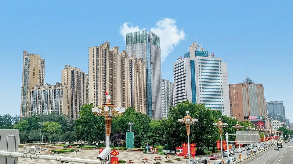
About Tangshan
Modern coal mining began here in the 1870s, and in 1881 a line built to carry the coal became China's first standard-gauge railway. After an earthquake flattened most of the industrial city in July 1976, the ruined casting shop of a locomotive works became the heart of the Tangshan Earthquake Ruins Memorial Park, and ground sunk by mining became the Tangshan Nanhu and Kailuan Scenic Area. In the north lie the Eastern Qing Tombs, a World Heritage site, and Great Wall passes such as Qingshanguan.
What to eat in Tangshan
- Chess-piece sesame flatbreads (棋子烧饼)
Listed sites in Tangshan
25 sites in Tangshan are on the official lists. Those with a page of their own link to it; the rest open as cards on the map.
- Eastern Qing Tombs 清东陵 5A scenic area · National heritage site
The burial ground of five Qing emperors (Shunzhi, Kangxi, Qianlong, Xianfeng and Tongzhi), 15 empresses and 136 imperial concubines, spread over about 80 square kilometres of hills around Changrui Mountain. - Tangshan Nanhu and Kailuan Scenic Area 唐山南湖·开滦 5A scenic area · National heritage site
Two linked parks in the middle of Tangshan: Nanhu, a lake park of nine lakes and five islands laid out on ground that sank after a century of coal mining, and the Kailuan National Mining Park beside it. - Baiyangyu Great Wall 白羊峪长城 4A scenic area · National heritage site · on the map
A stretch of Ming Great Wall about 4.5 km long along the ridges at Baiyangyu pass, with 21 towers, of which the Qian'an city government counts six as fairly complete. - Bodhi Island 菩提岛 4A scenic area · on the map
The wooded island of the three that make up Tangshan International Tourist Island, in the Bohai Sea off Laoting County; state media describe it as an island of old trees, in contrast to the sandy Yuetuo Island. - Caofeidian Wetland 曹妃甸湿地 4A scenic area · on the map
Part of a coastal wetland on the Bohai shore of Caofeidian District, made up of reed beds, marshes, fish ponds, shallow reservoirs and tidal flats; the provincial-level wetland and bird reserve covers about 110 square kilometres and lies on the East Asian–Australasian migratory route. - Doma Park, Caofeidian 多玛乐园 4A scenic area · on the map
A fishing-themed leisure park inside the Caofeidian wetland resort, where visitors catch fish, crabs and clams by traditional methods and by newer ones. - Fenghuang Mountain, Qianxi 凤凰山 4A scenic area · on the map
A limestone mountain about 400 m high in Xinji town, southern Qianxi, named for its resemblance to a phoenix with spread wings, with secondary forest and a Buddhist temple, Putuo Chan Temple, at its foot. - Hetou Old Street 河头老街 4A scenic area · on the map
A shopping, food and entertainment street built in old-street style on both banks of the Tangjin Canal, on the line of the 1881 coal canal that gave Hetou its name. - Huaxiang Guoxiang Rural Park, Qianxi 花乡果巷 4A scenic area · on the map
A rural-tourism zone in Qianxi built around flower and fruit farming, with oil-peony and kiwi-fruit farms and organic grain fields, approved as a national 'rural complex' pilot (the only one in Hebei when state media reported on it in 2020). - Jingzhong Mountain, Qianxi 景忠山 4A scenic area · on the map
A temple mountain about 610 m high in Qianxi, where Buddhist, Taoist and Confucian shrines stand in three clusters at the foot, middle and summit, joined by a stairway of 1,872 steps through pines more than 200 years old. - Lanyuewan Seaside Area, Caofeidian 揽月湾 4A scenic area · on the map
A seaside leisure area on the Bohai shore of Caofeidian New City, built around a sandy bay with about 12.8 km of shoreline and a 13.14 km coastal walking trail. - Li Dazhao Memorial Hall and Former Residence 李大钊纪念馆及故居 4A scenic area · National heritage site · on the map
Li Dazhao, an early leader of the Chinese Communist Party, was born in 1889 in Dahetuo village, where the three-courtyard farmhouse he grew up in is a nationally protected site. - Longjingguan Great Wall and Rafting Area 龙井关长城漂流 4A scenic area · on the map
A river-rafting scenic area at Longjingguan, a Ming Great Wall pass at the foot of Qi Mountain in Han'erzhuang, northern Qianxi. - Luanzhou Ancient City 滦州古城 4A scenic area · on the map
A reconstruction of the old walled town of Luanzhou in Ming-Qing style, opened in 2012, with a rebuilt city gate, bell and drum towers, a reception pavilion and the old county yamen from the 'Yang Sanjie' opera story. - Qinglong Mountain, Luanzhou 青龙山 4A scenic area · on the map
A forested mountain scenic area in the north-west of Luanzhou, a spur of the Yan Mountains, with Buddhist and Taoist temples and walking routes through pine and cypress woods. - Qingshanguan Great Wall 青山关 4A scenic area · National heritage site · on the map
A Great Wall pass in the mountains of north-eastern Qianxi, reckoned the best-preserved part of the county's Ming wall, with a surviving lift-type water gate, a 72-arch tower, the round 'Moon City' and a 'prison tower'. - Qixin Cement Industry Museum, Tangshan 唐山启新水泥工业博物馆 4A scenic area · on the map
A museum without walls on the site of the Qixin Cement Works, founded in 1889 as China's first cement works, with 24 old buildings kept, among them silos, a freight platform and red-brick walls. - Shangheyuan Tourist Area, Zunhua 尚禾源 4A scenic area · on the map
A leisure and rural-tourism area in Xingwangzhai town, west of Zunhua, centred on Lianxiang Town, a street of buildings built in old-street style that is hung with red lanterns for the New Year. - Shanyekou Scenic Area, Qian'an 山叶口 4A scenic area · on the map
A scenic area of about 14 square kilometres in the hills west of Qian'an, opened in 2011 and known for its stream-cut valley, a mountaintop lake and coloured conglomerate pebbles and boulders from very ancient rock. - Tangshan Science and Technology Museum 唐山市科技馆 4A scenic area · on the map
The municipal science and technology museum, in a large modern building in central Tangshan on the south side of Xinhua Road, just west of its crossing with Weiguo Road. - Yuetuo (Moon) Island 月坨岛 4A scenic area · on the map
A crescent-shaped sandy island in the Bohai Sea off Laoting County, one of the three islands of Tangshan International Tourist Island (with Bodhi and Xiangyun islands), which state media call a national demonstration base for island development. - Jingjue Temple, Yutian 净觉寺 National heritage site · on the map
A Buddhist temple in the countryside of Yutian County, traditionally said to date back to the Tang dynasty but mostly rebuilt in 1842–55 under the Qing. - Panjiayu Massacre Site and Memorial Hall 潘家峪惨案遗址 National heritage site · on the map
Panjiayu was a village used as a base by the Eastern Hebei anti-Japanese resistance, and on 25 January 1941 Japanese and puppet-government troops surrounded it and killed more than 1,200 villagers, described as the first large-scale atrocity under the Japanese 'Three Alls' policy. - Tangshan Earthquake Ruins Memorial Park 唐山地震遗址纪念公园 National heritage site
A memorial park built around the ruined steel-casting workshop of the former Tangshan Locomotive and Rolling Stock Works, left standing as evidence of the 7.8-magnitude earthquake of 28 July 1976 that flattened the city. - Tiangong Temple Pagoda 天宫寺塔 National heritage site
A thirteen-tier octagonal pagoda of brick and stone from the Liao dynasty, about 24 m high on a 5 m platform, completed in 1062 and the only part left of the former Tiangong Temple.
On the map
Open Tangshan on the illustrated map to see its outline, its places and listed sites together, and to add them to a trip.
Open Tangshan on the map