 Atlas of China
Mount Taibai 太白山Tàibái Shān
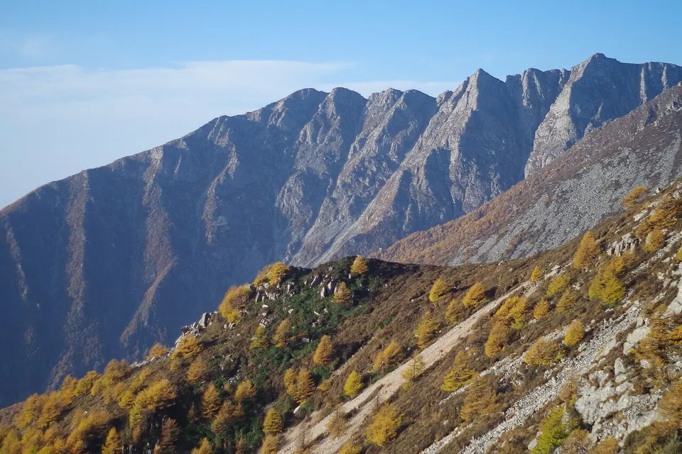
Forest roads and a cable car climb to 3,511 metres on the Qinling range's highest peak
- Best time
- May–Oct
- Time needed
- 1 day
- Days to budget
- 1 day
- Stay in
- Baoji
- Region
- Shaanxi
- Type
- Nature
- Listed as
- 5A scenic area
Why go to Mount Taibai
Mount Taibai, where Mei, Taibai and Zhouzhi counties meet, is the highest peak of the Qinling Mountains, the range commonly taken as the line between northern and southern China, and rises to about 3,770 metres at Baxian Tai. From the visitor centre at Tangyu, park buses climb through forest to Hongshuping, where the Tianxia cable car lifts you to Tianyuan Difang at 3,511 metres. Short walks lead on from the top station, but the summit lies a long, high hike beyond.
The story
'Snow on Taibai' is the last of the Eight Views of Guanzhong, the classic scenes of the Wei valley carved on a stele of 1680 that is now in Xi'an's Forest of Steles. The old saying puts the snow on the summit in the sixth month, but decades of warmer, drier weather have made lingering summer snow a rare sight.
What to see at Mount Taibai
- Tangyu hot springs 汤峪温泉: At the foot of the mountain, the low-mountain hot springs of Tangyu are a soothing end to a day of climbing, with water that comes out hot, rich in minerals and reported at up to about 72°C.
- Tianxia cable car and Tianyuan Difang 天下索道与天圆地方: The cable car lifts you from the forest zone to the top station at about 3,500 metres, where the 'Round Heaven, Square Earth' viewing area looks over the high Qinling ridges. Short walks start from here.
- Daye, Erye and Sanye lakes 大爷海、二爷海、三爷海: Three small high lakes near the summit, remnants of the glacial landscape. Tradition tied them to the three gods of Taibai. They lie a long, high walk beyond the top station, so ask at the park about which trails are open.
How to visit Mount Taibai
The usual way in is from the Tangyu side: take the park bus from the visitor centre up through the forest to the cable car, ride up to the top station, then walk the short developed trails. Allow a full day for the round trip, and more if you want to soak in the Tangyu hot springs afterwards. Summit lakes and the highest peak need a long, high hike through protected areas, so most visitors stay on the main trails.
How to get to Mount Taibai
High-speed trains from Xi'an North reach Baoji South in about an hour. From Baoji, take a bus to Mei County and then a local bus to the visitor centre at Tangyu, or allow about an hour by taxi or hired car; park buses run from the visitor centre to the cable car.
Where to stay
Tangyu, the small hot-spring town at the north foot of the mountain, is the best base for an early start at the visitor centre. Baoji and the Mei County seat are the larger alternatives, with more choice of rooms.
What to eat
- Qishan minced-meat noodles 岐山臊子面: Hand-made noodles in a sour, spicy broth topped with diced pork, the signature dish of Qishan in Baoji prefecture and common in the restaurants around the mountain.
- Mei County kiwifruit 眉县猕猴桃: Mei County, where the mountain's foothills lie, is one of China's best-known kiwifruit growing areas, with fresh fruit and juice sold in town.
Tips for visiting Mount Taibai
- The upper cable-car station is at 3,511 metres: walk slowly, and head back down if you get a headache, chest tightness or dizziness.
- Bring warm, waterproof layers even in summer: the weather changes fast, and sudden snow can halt park buses and close the park, so check its notices before you go.
- Stay on the developed trails: the Ao–Tai ridge traverse runs through the nature reserves' core zones, where unauthorised entry is banned and hikers have been fined.
Nearby
- Louguantai 楼观台 50 km
Taoist courtyards climbing to the terrace where Laozi is said to have taught - Famen Temple 法门寺 60 km
A Tang relic temple, the treasures of its sealed crypt and a 148-metre modern stupa - Baoji Bronze Ware Museum 宝鸡青铜器博物院 70 km
Zhou dynasty bronzes, led by the He zun and the earliest known written 'Zhongguo' - Qianling Mausoleum 乾陵 80 km
A spirit way of stone guardians climbing to the joint tomb of Gaozong and Wu Zetian - Small Wild Goose Pagoda 小雁塔 110 km
A slender Tang brick pagoda, cracked by earthquakes, in the grounds of the Xi'an Museum - Shaanxi History Museum 陕西历史博物馆 110 km
Tang gold and silver, original tomb murals and finds from Shaanxi's Zhou, Qin and Han past
Also within 30 km: Red River Valley Forest Park 红河谷森林公园 (10 km), Heihe National Forest Park 黑河国家森林公园 (10 km).
On the map
Open Mount Taibai on the illustrated map to see the terrain around it, what else is close, and to add it to a trip and plan the days.
Open Mount Taibai on the map