 Atlas of China
Yuan Dadu City Wall Ruins Park 元大都城垣遗址公园Yuán Dàdū Chéngyuán Yízhǐ Gōngyuán
National heritage site · Beijing, Beijing
- Time needed
- 1–2 hours
- Days to budget
- Half a day
- City
- Beijing
- Region
- Beijing
- Type
- Heritage
- Listed as
- National heritage site
About Yuan Dadu City Wall Ruins Park
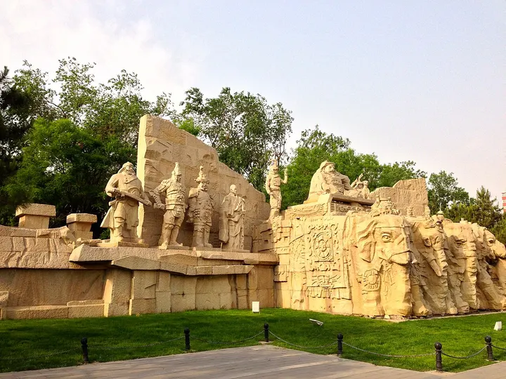
A narrow park about 9 km long that follows the surviving earth ramparts of the western and northern walls of Dadu, the Yuan dynasty capital built between 1267 and 1276, known locally as Tucheng ('earth wall'). Paths run along the grassed-over wall and the Xiaoyue River at its foot, past large sculpture groups including a statue of Kublai Khan, a crabapple grove and the Qianlong Emperor's 'Jimen Yanshu' stele of 1750.
How to get to Yuan Dadu City Wall Ruins Park
Runs between the 3rd and 4th Ring Roads across northern Haidian and Chaoyang districts; every subway Line 10 station from Xitucheng to Huixinxijie Nankou is close to it.
Nearby
- Bird's Nest and Olympic Green 奥林匹克公园 under 10 km
The Bird's Nest and Water Cube, venues of the 2008 and 2022 Olympics, lit up after dark - Temple of Confucius and Imperial Academy 孔庙和国子监 under 10 km
Courtyards of stone steles naming imperial exam graduates, beside the old Imperial Academy - Lama Temple 雍和宫 under 10 km
Incense-filled courtyards and an 18-metre sandalwood Buddha in a working monastery - Drum and Bell Towers 钟鼓楼 under 10 km
Beijing's old timekeeping towers, with drum performances and views over the hutong roofs - Shichahai 什刹海 under 10 km
Three linked lakes ringed by hutongs and lakeside bars, with open-air skating in winter
Also within 20 km: Xihuang Temple 西黄寺 (under 10 km), Temple of Earth 地坛 (under 10 km), Deshengmen Arrow Tower 德胜门箭楼 (under 10 km), Former Residence of Soong Ching-ling 宋庆龄故居 (under 10 km), Bailin Temple 柏林寺 (under 10 km), Wen Tianxiang Temple 文天祥祠 (under 10 km).
On the map
Open Yuan Dadu City Wall Ruins Park on the illustrated map to see the terrain around it and what else is close, and to add it to a trip.
Open Yuan Dadu City Wall Ruins Park on the map