 Atlas of China
Guangzhou Urban Planning Exhibition Center 广州市城市规划展览中心Guǎngzhōu Shì Chéngshì Guīhuà Zhǎnlǎn Zhōngxīn
4A scenic area · Guangzhou, Guangdong
- Time needed
- 1–2 hours
- Days to budget
- Half a day
- City
- Guangzhou
- Region
- Guangdong
- Type
- Culture
- Listed as
- 4A scenic area
About Guangzhou Urban Planning Exhibition Center
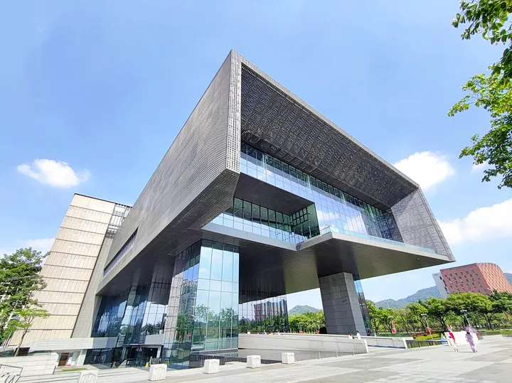
Designed by the architect He Jingtang and set at the western foot of Baiyun Mountain in the new Baiyun district, this exhibition centre tells the story of Guangzhou's history and planning. Displays include a large scale model of the whole city, galleries on urban history, transport and future master plans, and short films in a 4D cinema, and the building also houses the city's local gazetteer library.
How to get to Guangzhou Urban Planning Exhibition Center
At 1 Zhanlan Road in Baiyun District, about 7 km north of the old city centre, near Baiyun Cultural Square metro station. Closed on Mondays.
Nearby
- Canton Tower & Pearl River 广州塔 10 km
A slim-waisted tower glowing over the Pearl River in China's Cantonese food capital
Also within 20 km: Sanyuanli Anti-British Struggle Memorial Hall 三元里平英团遗址 (under 10 km), Baiyun Mountain 白云山 (under 10 km), Xianxian Mosque and Tomb of Sa'd ibn Abi Waqqas 清真先贤古墓 (under 10 km), Huanghuagang Mausoleum of the 72 Martyrs 黄花岗七十二烈士墓 (under 10 km), Yuexiu Park and Zhenhai Tower 越秀公园 (under 10 km), Shennong Caotang Museum of Traditional Chinese Medicine 神农草堂中医药博物馆 (under 10 km).
On the map
Open Guangzhou Urban Planning Exhibition Center on the illustrated map to see the terrain around it and what else is close, and to add it to a trip.
Open Guangzhou Urban Planning Exhibition Center on the map