 Atlas of China
Chamdo 昌都Chāngdū
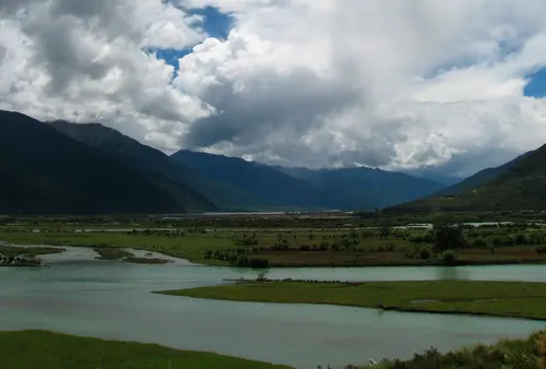
The river valleys of Kham, a Bön mountain monastery and salt pans on the Mekong
About Chamdo
Chamdo, the gateway to eastern Tibet, lies in the old Kham region, where the Jinsha (upper Yangtze), Lancang (Mekong) and Nu (Salween) cut through the Hengduan Mountains. The city's Galden Jampaling was the first Gelug monastery in Kham, and just to the south the Karuo Neolithic Site has revealed a farming village of around 5,000 years ago. Farther out stand Riwoche Monastery, the Bön monastery of Zizhu on its sacred mountain, and the Yanjing Ancient Salt Terraces beside the Lancang.
Listed sites in Chamdo
11 sites in Chamdo are on the official lists. Those with a page of their own link to it; the rest open as cards on the map.
- Gangtuo Village 岗托村 4A scenic area · on the map
Gangtuo, on the west bank of the Jinsha River where National Road 317 crosses from Sichuan into Tibet, is where units of the People's Liberation Army's 18th Army crossed the river in October 1950 and raised the first PRC national flag in Tibet, which gave the village the title 'First Village of Tibet's Liberation'. - Sanse Lakes (Three-Coloured Lakes) 三色湖 4A scenic area · on the map
Three small lakes lie close together in Puyu village, Banbar town, each a different colour, and are known as the black, white and yellow lakes. - Yanjing Ancient Salt Terraces 盐井古盐田 4A scenic area · National heritage site · on the map
On the steep banks of the Lancang (Mekong) at Yanjing, families still make salt the traditional way: brine is carried up from wells by the river, poured onto flat terraces built on timber posts and left to dry in the sun and wind. - Zizhu Monastery 孜珠寺 4A scenic area · on the map
Zizhu Monastery, regarded as one of the oldest and most important monasteries of the Bön religion, is spread across the six limestone peaks of Zizhu mountain, one of Bön's four sacred mountains, at about 4,800 metres. - Dalü Palace, Gonjo 达律王府 National heritage site · on the map
The old residence of the Dalü family, once rulers of Gonjo, known locally as the Dalü Gyalpo Lhakhang ('palace of King Dalü'), stands in Zongka hamlet about 1 km from the centre of Gonjo county town, and the family's descendants still live there. - Former Office of the Chamdo People's Liberation Committee 昌都地区人民解放委员会办公旧址 National heritage site · on the map
The Chamdo People's Liberation Committee, a provisional local administration, was formed at a congress held in Chamdo from 27 December 1950 to 1 January 1951, after the Battle of Chamdo that October. - Galden Jampaling Monastery 强巴林寺 National heritage site
Galden Jampaling, regarded as Kham's largest Gelug monastery, stands on a terrace above the river confluence in the heart of Chamdo and was founded in the 1430s or 1440s by Jangsem Sherab Zangpo, a disciple of Tsongkhapa, as the first Gelug monastery in Kham. - Karuo Neolithic Site 卡若遗址 National heritage site · on the map
Karuo, on a ridge where the Karuo river meets the Lancang (Mekong), is the type site of the Karuo culture, a farming village of some 4,000–5,000 years ago first excavated in 1978–79. - Nangba Langze Stone Sculptures 囊巴朗则石雕 National heritage site · on the map
Inside a small temple hall at Randui village, Bangda township, sit nine stone figures carved in the late 8th or early 9th century: Vairocana in the centre with the Eight Great Bodhisattvas, four on each side. - Renda Cliff Carvings 仁达摩崖造像 National heritage site · on the map
A Buddhist relief cut into the cliff at Renda in 804 by monks of the Tibetan Empire to honour the king. - Riwoche Monastery 类乌齐寺 National heritage site · on the map
A Taklung Kagyu monastery founded in the 1270s by Sangye Ön, which became the seat of the school's 'lower' branch in Kham and one of the largest monasteries of eastern Tibet.
On the map
Open Chamdo on the illustrated map to see its outline, its places and listed sites together, and to add them to a trip.
Open Chamdo on the map