 Atlas of China
Lüliang 吕梁Lǚliáng
A Yellow River port, cave-dwelling villages and the home of Fenjiu
About Lüliang
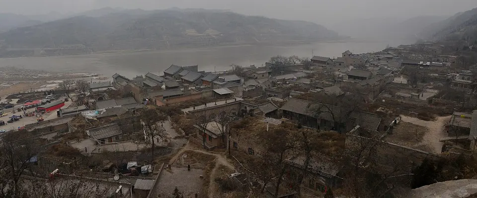
Lüliang spreads over loess ridges between the Fen and Yellow rivers, and its draw is the rural west. Qikou, a Ming and Qing river port, has old shop fronts below the Black Dragon Temple, and Lijiashan nearby is a protected village of cave dwellings. At Xinghua Village, near Fenyang, Fenjiu grain spirit is distilled, and Xuanzhong Temple near Jiaocheng is one of the cradles of Pure Land Buddhism in China and Japan.
What to eat in Lüliang
- Fenjiu grain spirit (汾酒)
- Liulin wantuan (柳林碗团)
Featured places in Lüliang
-
Qikou Ancient Town and Lijiashan Village 碛口古镇·李家山村
Stone lanes of an old Yellow River port and a hillside village of stacked cave homes
Listed sites in Lüliang
44 listed sites are in Lüliang. These are the 14 rated 5A or 4A; see all 44 in the Shanxi list.
- Baima Xiandong Cave 白马仙洞 4A scenic area · on the map
A cave on Jiufeng Hill at Donggou village in Wucheng town, south-east of Lishi, set among wooded hills. - Dadonggou Forest Scenic Area 大东沟景区 4A scenic area · on the map
A forest leisure area in the Guandi Mountains in Xinyi town, in the hills north-east of Lishi, where the road climbs past Qiannian village into birch woods along a stream below Guji Mountain. - Fenjiu Culture Scenic Area, Xinghuacun 杏花村汾酒文化景区 4A scenic area · National heritage site · on the map
A liquor-heritage visitor area built around the Fenjiu distillery in Xinghuacun town, the home of Fenjiu, a light-aroma Chinese grain spirit. - Guashan Tianning Temple 卦山天宁寺 4A scenic area · National heritage site · on the map
A Buddhist temple complex on Gua Mountain, 3 km from Jiaocheng, which the county government dates to 627 and describes as a major Huayan temple of the Tang dynasty. - Heichashan April 8 Martyrs' Memorial 黑茶山四八烈士纪念地 4A scenic area · on the map
A memorial museum at the foot of Mount Heicha in Xing county, built for the people killed when a flight from Chongqing to Yan'an crashed into the mountain in fog on 8 April 1946. - Jiajiazhuang Village Tourist Area 贾家庄文化生态旅游区 4A scenic area · on the map
A tourist area built around Jiajiazhuang, a village north-east of Fenyang that was a national model for agriculture from the 1950s to the 1970s and has since turned to rural tourism. - Jinlong Mountain Scenic Area 金龙山风景区 4A scenic area · on the map
A hillside complex of Buddhist and Daoist shrines at Xiatujing village, west of Xiaoyi, built around the site of an old Dragon King temple on the hilltop. - Jinsui Border Region Memorial Hall, Caijiaya 晋绥边区革命纪念馆 4A scenic area · National heritage site · on the map
A memorial museum at Caijiaya village in Xing county, set in the compound that was the seat of the Jinsui Border Region government and military headquarters during the war against Japan and the civil war. - Mount Beiwudang 北武当山 4A scenic area
A mountain scenic area in Fangshan county, in the Lüliang range, which is a national-level scenic area and one of northern China's Daoist holy mountains. - Sanhuang Temple, Xiaoyi 孝义三皇庙 4A scenic area · National heritage site · on the map
A temple to the Three Sovereigns of Chinese legend, Fuxi, Shennong and the Yellow Emperor, who are honoured together in one hall in Jiajiazhuang village on the western edge of Xiaoyi. - Shengxi Lake Forest Park 胜溪湖森林公园 4A scenic area · on the map
A large city park in Xiaoyi laid out around a lake, which Shanxi named a five-star urban park in 2013. - Xiaohe National Wetland Park 孝河国家湿地公园 4A scenic area · on the map
A wetland park around a reservoir on the Xiao River on the western side of Xiaoyi, with a planned area of 5.47 sq km of which about 3.28 sq km is water. - Xuanzhong Temple 玄中寺 4A scenic area · National heritage site · on the map
A Buddhist temple in the Shibi valley that Chinese and Japanese Buddhists regard as the ancestral temple of the Pure Land school, founded in 472 in the Northern Wei period according to the Lüliang government. - Yiju Temple 义居寺 4A scenic area · National heritage site · on the map
A Buddhist temple at Zaogeda village in Sanjiao town, on a hillside beside a river, which was formerly called the Fotang Temple and served as a branch of the Tiangong Temple; the county government gives its area as 56,000 sq m.
On the map
Open Lüliang on the illustrated map to see its outline, its places and listed sites together, and to add them to a trip.
Open Lüliang on the map