 Atlas of China
Mount Beiwudang 北武当山Běiwǔdāng Shān
4A scenic area · Lüliang, Shanxi
- Time needed
- Half a day
- Days to budget
- Half a day
- City
- Lüliang
- Region
- Shanxi
- Type
- Nature
- Listed as
- 4A scenic area
About Mount Beiwudang
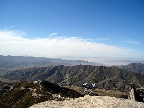
A mountain scenic area in Fangshan county, in the Lüliang range, which is a national-level scenic area and one of northern China's Daoist holy mountains. The county government gives its area as 88 sq km, of which fewer than 20 sq km are open, with 72 peaks, 36 cliffs and 24 ravines; visitors climb a stepped path of about 1,455 steps past ancient pines and rock formations to the temples on the summit, and there are also 5.5 km of wooden walkways. A temple fair is held in the first days of the third lunar month.
How to get to Mount Beiwudang
It is in the mountains about 16 km south-east of Fangshan county town and, according to the county government, about 33 km from Lüliang railway station.
Nearby
- Qikou Ancient Town and Lijiashan Village 碛口古镇·李家山村 50 km
Stone lanes of an old Yellow River port and a hillside village of stacked cave homes
Also within 20 km: Former Residence of Yu Chenglong 于成龙故居 (under 10 km), Nancun City Site (Zuoguocheng) 南村城址 (10 km), Dadonggou Forest Scenic Area 大东沟景区 (20 km).
On the map
Open Mount Beiwudang on the illustrated map to see the terrain around it and what else is close, and to add it to a trip.
Open Mount Beiwudang on the map