 Atlas of China
Xiangyang 襄阳Xiāngyáng
'Iron Xiangyang', a moated walled city on the Han, and Zhuge Liang's retreat
About Xiangyang
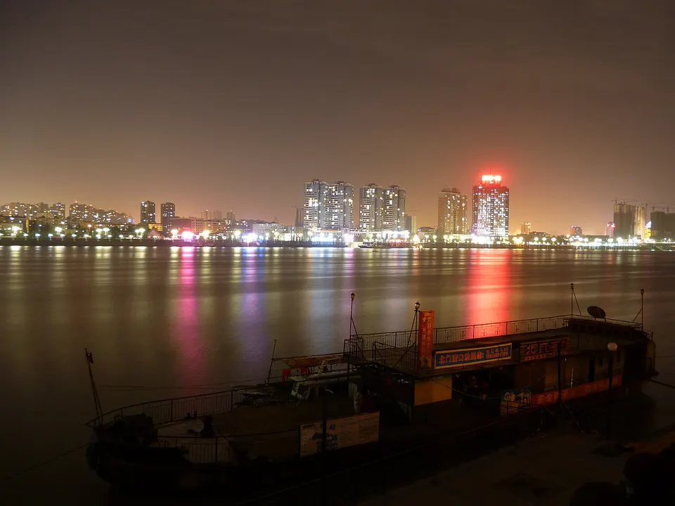
Xiangyang guarded the Han River crossing between north and south China, and its high walls and broad moat earned it the name 'Iron Xiangyang'. The old walled city faces Fancheng across the river, and west of town lies Longzhong, where the strategist Zhuge Liang lived before he joined Liu Bei in the Three Kingdoms era. Migong Temple in Fancheng honours the Song calligrapher Mi Fu, while Tang City and the OCT Fantasy Resort are modern additions on the edge of town.
What to eat in Xiangyang
- Xiangyang beef noodles (襄阳牛肉面)
Listed sites in Xiangyang
26 sites in Xiangyang are on the official lists. Those with a page of their own link to it; the rest open as cards on the map.
- Longzhong 古隆中 5A scenic area · National heritage site
Longzhong is the wooded hillside west of Xiangyang that tradition names as the place where the Three Kingdoms strategist Zhuge Liang lived quietly before Liu Bei called on him three times, the origin of the saying about visiting the thatched cottage three times. - Baishui Temple, Zaoyang 白水寺 4A scenic area · on the map
A hilltop temple complex at Wudian, south of Zaoyang, commemorating Liu Xiu (Emperor Guangwu), founder of the Eastern Han dynasty, whose ancestral home is placed in this district. - China Han City, Zaoyang 中国汉城 4A scenic area · on the map
A Han-dynasty-style capital built in modern times on the eastern side of Zaoyang to honour Liu Xiu (Emperor Guangwu) and present Han culture; it is a themed attraction and film location, not a historic site. - Daxie Mountain 大薤山 4A scenic area · on the map
A forested mountain in south-western Gucheng, run as a national forest park and holiday area, whose main peak, Daughter Peak, reaches about 1,099 m. - Hengchong Mountain Scenic Area 横冲 4A scenic area · on the map
A high-mountain forest area on the main ridge of the Jing Mountains in Houping town, at about 1,700 m on average and rising to just under 1,950 m, so it stays cool in summer. - Huangjiawan Scenic Area 黄家湾 4A scenic area · on the map
A leisure area of about 9.8 km² on the western outskirts of Xiangyang's Xiangcheng district, which local tradition names as the birthplace of Huang Yueying, the wife of Zhuge Liang. - Jiulu Zhai, Baokang 九路寨 4A scenic area · on the map
A karst mountain area in Xiema town, in the south of Baokang County, at about 1,200 m on average. - Liuzhuya Mountain Resort, Baokang 六柱垭 4A scenic area · on the map
A high-mountain leisure area at up to about 1,500 m, built on reclaimed phosphate-mining land in Huanglongguan village, Maqiao town, and rated 4A in 2024. - Lumen Mountain, Xiangyang 鹿门山 4A scenic area · on the map
A wooded hill south-east of Xiangyang, once called Suling Mountain, whose present name comes from a shrine said to have been founded in the Eastern Han with a pair of stone deer beside its path. - Nanzhang Mountain Strongholds 南漳山寨群 4A scenic area · National heritage site · on the map
Nanzhang County has more than a thousand old stone mountain strongholds, and six built by local communities as refuges in the Ming and Qing dynasties make up the national listing. - OCT Fantasy Resort, Xiangyang 襄阳华侨城奇幻度假区 4A scenic area · on the map
A large leisure resort developed by OCT in Xiangyang's Dongjin New Area, opened in stages from 2020. - Shiziyan Reservoir Scenic Area 狮子岩 4A scenic area · on the map
A lakeside scenic area in Jinniusi village, Cihe town, built around Shiziyan Reservoir (completed in 1976 on the Mo River, a tributary of the Han) and named for a hill said to resemble a lion. - Tang City, Xiangyang 襄阳唐城 4A scenic area · on the map
A Tang-dynasty-style film set and tourist complex at the foot of Xianshou Hill beside the Han River, built in the 2010s and now marketed as Shengshi Tangcheng ('Prosperous Tang City'); none of it is historic. - Wudaoxia Gorge 五道峡 4A scenic area · on the map
A forested stream gorge inside the Wudaoxia nature reserve, close to the main peak of the Jing Mountains, with a path of about 5 km beside the stream, waterfalls and old trees including a golden-thread nanmu. - Xiangshui River Gorge 香水河 4A scenic area · on the map
A forested river gorge at Putuo'an village in Xueping town, in the south-west of Nanzhang County, known for its chain of waterfalls, with more than fifty named sights including the Seven-Colour Falls and the Three-Tier Falls. - Xiangyang Ancient City 襄阳古城 4A scenic area · National heritage site · on the map
The walled old city of Xiangyang on the south bank of the Han River, whose mostly Ming-dynasty walls, 7.3 km round, are a national monument and are ringed by a moat up to 250 m wide, the basis of the saying 'iron Xiangyang'. - Yanhe Village 堰河村 4A scenic area · on the map
A tea-growing village in Wushan town, Gucheng, developed into a rural-tourism area; the county tourism bureau reports about 1,200 mu (80 ha) of tea gardens and more than fifty family-run farm restaurants and guesthouses in the village. - Yaozhihe Resort, Baokang 尧治河 4A scenic area · on the map
A mountain village in Maqiao town, near the Fang County and Shennongjia borders, that has turned from phosphate mining to tourism. - Chuhuangcheng City Ruins 楚皇城 National heritage site · on the map
The rammed-earth walls of a large walled city from the Eastern Zhou to Han periods, covering about 2.2 km² beside Zhengji town, with a smaller inner town in the north-east. - Cihe Cheng'en Temple 茨河承恩寺 National heritage site · on the map
A Ming-dynasty Buddhist temple in a valley on the north side of Wuduo Mountain in Cihe town, south-eastern Gucheng. - Fenghuangzui Site, Xiangyang 凤凰咀遗址 National heritage site · on the map
A Neolithic walled settlement at Longwang town, north-west of Xiangyang, dated by the provincial culture and tourism department to roughly 5,200 to 3,900 years ago and described as the largest and highest-ranking central settlement found so far in the Nanyang–Xiangyang Basin. - Green Screen Wall, Xiangyang Prince's Palace 襄阳王府绿影壁 National heritage site
The only part of the Ming prince of Xiang's palace in Xiangyang to survive its burning in 1641 is this stone screen wall, about 25 m long and up to 6.6 m high, carved with dragons among clouds and waves and named for its dark green colour. - Guangde Temple, Xiangyang 广德寺 National heritage site
A working Buddhist temple on the western edge of Xiangyang, founded in the Tang dynasty as Yunju Temple and renamed Guangde in the Ming. - Li Zengbo Victory Inscription 李曾伯纪功铭 National heritage site · on the map
A Southern Song cliff inscription carved in 1254 on a rock face at the east foot of Zhenwu Hill, beside the entrance to the Xianshan greenway south-west of Xiangyang's old city. - Migong Temple 米公祠 National heritage site
A shrine on the north bank of the Han River in Fancheng, first built in the Yuan dynasty, enlarged in the Ming and rebuilt in the Qing, and dedicated to the Northern Song calligrapher Mi Fu, who took the sobriquet 'Idle Scholar of Xiangyang'. - Xiangfan Wharves, Xiangyang 襄樊码头遗址 National heritage site · on the map
The surviving river landings on both banks of the Han River at Xiangyang's old city and across the river at Fancheng, 26 of which make up this national heritage unit; they recall the city's old role as a crossing of boat and road routes, summed up as 'southern boats, northern horses', and belong to the Wanli Tea Road World Heritage nomination.
On the map
Open Xiangyang on the illustrated map to see its outline, its places and listed sites together, and to add them to a trip.
Open Xiangyang on the map