 Atlas of China
Handan 邯郸Hándān
Zhao's old capital, echoing Buddhist caves and a walled tai chi town
About Handan
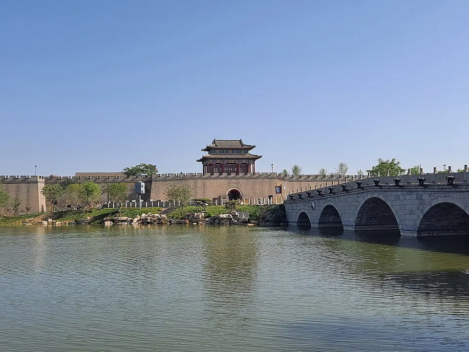
Handan was capital of the state of Zhao for 158 years from 386 BC, and Chinese idioms such as learning to walk in Handan, for clumsy imitation, are credited to the city. To the south-west, the Xiangtangshan Caves were carved for Northern Qi rulers in the sixth century, and many of their sculptures now sit in museums abroad. Guangfu Ancient City, walled and moated, is where Yang and Wu tai chi began, and the Nüwa Palace honours the goddess said to have made humankind.
What to eat in Handan
- Daming Ermao chicken (二毛烧鸡)
- Wu'an pulled noodles (武安拉面)
Listed sites in Handan
48 listed sites are in Handan. These are the 23 rated 5A or 4A; see all 48 in the Hebei list.
- Guangfu Ancient City 广府古城 5A scenic area · National heritage site · on the map
A walled Ming-dynasty prefectural city on a peninsula in the Yongnian wetland, with a moat outside walls about 4.5 km round that were rebuilt in brick from 1542. - Nüwa Palace 娲皇宫 5A scenic area · National heritage site
A temple complex dedicated to the mythical goddess Nüwa, who is said to have mended the sky and made humankind, with halls and pavilions built out along the cliff face of Fenghuang (Phoenix) Mountain, the present buildings dating from the Ming and Qing periods. - Book of Songs Culture Park, Jize 诗经文化园 4A scenic area · on the map
A landscaped culture park in Jize county town named for the Book of Songs, the ancient poetry anthology whose surviving text is the version annotated by Mao Heng and Mao Chang, scholars that the Jize gazetteer counts as locals. - Changshou Village Scenic Area, Wu'an 长寿村 4A scenic area · on the map
A mountain village in Huoshui township, in the Taihang Mountains of western Wu'an, run as a scenic area for rest and health holidays, with guesthouses in converted village houses. - Chaoyanggou, Wu'an 朝阳沟 4A scenic area · on the map
A wooded valley scenic area in the Taihang Mountains of north-west Wu'an, themed on the Henan opera Chaoyanggou, a 1958 play about an urban student who settles in a mountain village, and on rural 'educated youth' culture. - Congtai Liquor Garden 丛台酒苑 4A scenic area · on the map
A visitor park at the Congtai liquor distillery in Feixiang's economic development zone, built around a museum in Warring States and Han style with some 13,800 m² of floor space. - Congtai Park 丛台公园 4A scenic area
A city park in the middle of Handan, first planned in 1939 to protect the Wuling Congtai, a terraced tower traditionally linked to King Wuling of Zhao in the Warring States period. - Daming Ancient City 大名古城 4A scenic area · on the map
The walled county town of Daming, rebuilt in 1401 on the north bank of the Wei River after floods destroyed the Song-era city to the north-east, with walls about 4.5 km round and four gates. - Dongshan Culture and Arts Park, Wu'an 东山文化博艺园 4A scenic area · on the map
A landscaped park on the east side of Wu'an, laid out in 2003 on about 500 mu (roughly 33 ha) with pavilions, bridges and ponds, and divided into seven zones that include geology, plants and folk-culture areas. - East Taihang Scenic Area 东太行 4A scenic area · on the map
A mountain scenic area on the eastern side of the Taihang range in north-west Wu'an, with a planned area of about 26 square kilometres and a highest point of 1,428 m at North Peak. - Eighth Route Army 129th Division Headquarters 八路军一二九师司令部旧址 4A scenic area · National heritage site · on the map
Chi'an village in Henandian township was the headquarters of the Eighth Route Army's 129th Division under Liu Bocheng and Deng Xiaoping during the war against Japan, and it is now a memorial complex. - Grain Painting Town, Guantao 粮画小镇 4A scenic area · on the map
A rural tourist village on the west side of Guantao, developed since 2014 from a poor village into a showcase 'beautiful village' planned over 3.7 square kilometres and organised as four adjoining village communities. - Gu Wudang Mountain 古武当山 4A scenic area · on the map
A mountain scenic area in the Taihang range north-west of Wu'an, whose main summit, the Golden Peak, rises above 1,400 m. - Handan Garden Expo Park 邯郸园博园 4A scenic area · on the map
A large landscaped park on the western edge of Handan, laid out for the 2020 Hebei Garden Expo on land that had held foundries, steel-slag works and construction-waste dumps. - Hanwang Jiuzhai Scenic Area 韩王九寨 4A scenic area · on the map
A mountain scenic area in the Taihang foothills south of She County town, in the Qingzhang River area, themed in part on the Han general Han Xin, with a 'Han King Valley', re-created 'Qin' and 'Han' stockade settings, hiking routes to summit viewpoints and mountain camping. - Jin-Ji-Lu-Yu Martyrs' Cemetery 晋冀鲁豫烈士陵园 4A scenic area · National heritage site
A memorial cemetery and museum in southern Handan, inaugurated in October 1950 with the reburial of General Zuo Quan and other soldiers of the Jin-Ji-Lu-Yu border region, and described as the first martyrs' cemetery built after the founding of the People's Republic. - Jingniang Lake 京娘湖 4A scenic area · on the map
A mountain reservoir in the Taihang foothills of north-west Wu'an, formally the Koushang Reservoir (built 1966–69) and better known by the name of the folk tale in which the future Song founder Zhao Kuangyin rescues a kidnapped girl, Zhao Jingniang, and escorts her home. - Qibugou Scenic Area 七步沟 4A scenic area · on the map
A mountain valley scenic area in the Taihang foothills of Huoshui township, north-west of Wu'an, near Qibugou village. - Taihang Wuzhi Mountain 太行五指山 4A scenic area · on the map
A mountain scenic area south of Shexian town, named for five peaks that resemble the fingers of the Buddha's hand, the highest reaching 1,283 m. - Tianbaozhai Scenic Area 天保寨 4A scenic area · on the map
A hill-country scenic area around Huatuo village in Taoquan township, in the far west of Ci County, developed from 2017 by a county-owned coal company after its mine closed; villagers replanted the slopes with more than a million saplings. - Xiangtangshan Caves 响堂山石窟 4A scenic area · National heritage site
A group of Buddhist cave temples cut into the limestone of Mount Gu and Mount Fu, begun under the Eastern Wei and carved chiefly under the Northern Qi (550–577), whose capital stood at nearby Ye. - Zhaowang Impression City 赵王印象城 4A scenic area · on the map
A corporate culture-and-tourism park in Guangping, run by a food and liquor producer and themed on the Warring States state of Zhao. - Zhaoyuan Park 赵苑公园 4A scenic area · on the map
A large landscaped park in north-west Handan, opened in 2004 and built in the style of the Warring States Zhao kingdom, with lakes, lotus ponds and a series of themed garden zones.
On the map
Open Handan on the illustrated map to see its outline, its places and listed sites together, and to add them to a trip.
Open Handan on the map