 Atlas of China
Gannan 甘南Gānnán
Monastery towns, Yellow River grassland and limestone peaks in Amdo
- Type
- Tibetan Autonomous Prefecture
- Region
- Gansu
- Seat
- Hezuo
- Featured places
- 1
- Listed sites
- 121 rated 5A · 10 rated 4A · 3 national heritage
About Gannan
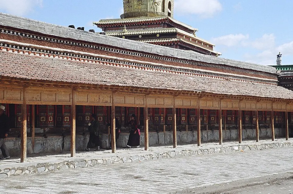
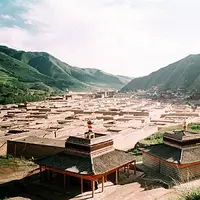
Gannan, Kanlho in Tibetan, lies in Amdo, where the Tibetan Plateau meets the hills of southern Gansu, and Tibetans make up just over half its people. At Xiahe, pilgrims walk the 3.5 km corridor of prayer wheels around Labrang Monastery, founded in 1709 and one of the six great monasteries of the Gelug school. Beyond lie the herders' grasslands of Maqu inside the Yellow River's first great bend, the Tibetan villages of Zhagana beneath limestone peaks, and the forests and lakes of Yeliguan.
Featured places in Gannan
-
Labrang Monastery 拉卜楞寺
A living Tibetan Buddhist monastery town, ringed by a long corridor of prayer wheels
Listed sites in Gannan
12 sites in Gannan are on the official lists. Those with a page of their own link to it; the rest open as cards on the map.
- Yeliguan Scenic Area 冶力关 5A scenic area · on the map
A mountain and forest scenic area around Yeliguan town in Lintan county, on the north-eastern edge of the Tibetan Plateau, rated a national 5A area in 2024. - Awancang Wetland 阿万仓湿地 4A scenic area · on the map
A broad wetland grassland around Awancang town in Maqu county, inside the great loop of the upper Yellow River known as its First Bend, where the river's side channels meander through pasture, pools and marsh. - Ciri'na and Mao Zedong's Former Residence 茨日那毛泽东旧居 4A scenic area · on the map
A Tibetan village on the Bailong River in Wangzang town, Têwo county, where the Central Red Army stayed in September 1935 on the first stage of its Long March through Gansu; Mao Zedong lodged in a two-storey Tibetan house of rammed-earth walls and log beams. - Dangzhou Grassland 当周草原 4A scenic area · on the map
A grassland scenic area on the edge of Hezuo, the capital of Gannan Tibetan Autonomous Prefecture, made up of the Dangzhou grassland park and the forested South Mountain, with natural pasture and summer wildflowers. - Dayu Valley 大峪沟 4A scenic area · on the map
A valley system in the Dieshan range south of Jonê county town, inside the Tao River National Nature Reserve, where a tributary of the Tao River runs for about 70 km through forest, alpine meadow and wetland below Zhayikega, the 4,920 m main peak of the Dieshan. - Ejie Meeting Site 俄界会议旧址 4A scenic area · National heritage site · on the map
A Tibetan village house in Gaoji village, Dala township, where the Politburo of the Communist Party of China held an enlarged meeting on 12 September 1935, the day after the Central Red Army's Long March column crossed into Gansu from Sichuan; 'Ejie' is a Chinese rendering of the Tibetan name Gaoji. - Ganjia Grassland and Bajiaocheng 甘加秘境 4A scenic area · National heritage site · on the map
A high grassland basin in the north of Xiahe county with pastures, rivers and gorges below the long Baishiya cliff, at whose foot stand Baishiya Monastery and the Baishiya Karst Cave, a Tibetan Buddhist pilgrimage cave where a Denisovan jawbone about 160,000 years old was found. - Laga Mountain 拉尕山 4A scenic area · on the map
A mountain area 33 km west of Zhouqu county town, between Jiuzhaigou and Lazikou, whose Tibetan name means 'a place the immortals love'. - Lazikou Pass 腊子口 4A scenic area · on the map
A narrow gorge in the Min Mountains of Têwo county where the Lazi River runs between sheer cliffs, for centuries the main way between northern Sichuan and southern Gansu. - Zecha Stone Forest 则岔石林 4A scenic area · on the map
A gorge in Larenguan township, Luqu county, where sheer rock walls and pinnacles rise above grassland and dense forest, shaped over a long time by wind, rain and running water; fossils of ancient sea creatures are found on the peaks and in the caves. - Zhagana 扎尕那 4A scenic area · on the map
A cluster of Tibetan villages inside a natural 'stone city' of limestone peaks north of Têwo county town; the name is Tibetan for 'stone box'. - Taozhou Garrison Town 洮州卫城 National heritage site
The walls of a Ming garrison town, rebuilt from 1379 as the seat of the Taozhou Guard on the old Tang–Tibet road, which still enclose the small town of Xincheng in Lintan county; it is regarded as the largest surviving garrison town (weicheng) in China.
On the map
Open Gannan on the illustrated map to see its outline, its places and listed sites together, and to add them to a trip.
Open Gannan on the map