 Atlas of China
Nanxi River Scenic Area 楠溪江Nánxī Jiāng
4A scenic area · Wenzhou, Zhejiang
- Time needed
- 1–2 days
- Days to budget
- 1½ days
- City
- Wenzhou
- Region
- Zhejiang
- Type
- Nature
- Listed as
- 4A scenic area
About Nanxi River Scenic Area
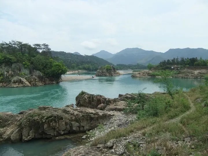
A national scenic area along the Nanxi River, a clear, shallow tributary of the Ou that winds south through Yongjia County in 36 bends and 72 shoals, with pebble beaches, volcanic cliffs, waterfalls and the old clan villages of its middle reaches. Its eight sections include Daruoyan, where Taogong Cave, a huge natural cavern, was the retreat of the Daoist scholar Tao Hongjing. The river is on China's tentative list for World Heritage and forms the western part of the Yandangshan Global Geopark.
How to get to Nanxi River Scenic Area
Nanxijiang station on the Hangzhou–Wenzhou high-speed railway (opened 2024) is in the middle reaches near Yantou; roads also run up the valley from Oubei, across the Ou River from central Wenzhou.
Nearby
Also within 20 km: Furong Village 芙蓉村 (under 10 km), Jinzhao and Xiantai Archways 金昭牌坊和宪台牌坊 (10 km), Former Headquarters of the Red 13th Army 红十三军军部旧址 (10 km), Middle Yandang Mountain 中雁荡山 (20 km), Nanxi River Ancestral Halls 楠溪江宗祠建筑群 (20 km).
On the map
Open Nanxi River Scenic Area on the illustrated map to see the terrain around it and what else is close, and to add it to a trip.
Open Nanxi River Scenic Area on the map