 Atlas of China
Wanfenglin Peak Forest 万峰林Wànfēnglín
5A scenic area · Qianxinan, Guizhou
- Time needed
- Half a day to 1 day
- Days to budget
- 1 day
- City
- Qianxinan
- Region
- Guizhou
- Type
- Nature
- Listed as
- 5A scenic area
About Wanfenglin Peak Forest
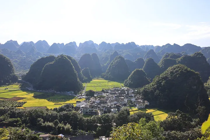
Wanfenglin is a plain of cone-shaped karst peaks south of Xingyi; UNESCO's geopark profile counts more than 20,000 of them. Roads and footpaths wind between the peaks past farmland and Buyei villages, and the area has one of Guizhou's larger clusters of homestays. It lies within the Xingyi UNESCO Global Geopark, designated in 2024, and was rated a 5A scenic area in December 2024.
How to get to Wanfenglin Peak Forest
About 12 km south of central Xingyi by road; Xingyi has an airport and high-speed rail service.
Nearby
- Luoping Rapeseed Fields 罗平油菜花海 50 km
Seas of golden rapeseed flowers swirling around karst peaks and spiral terraces
Also within 20 km: Liu Family Manor, Xingyi 兴义刘氏庄园 (under 10 km), Guizhou Chun Leisure Park 贵州醇景区 (under 10 km), Wanfeng Lake 万峰湖 (10 km), Maling River Canyon 马岭河峡谷 (10 km), Xingyi Geopark Museum 兴义国家地质公园博物馆 (20 km).
On the map
Open Wanfenglin Peak Forest on the illustrated map to see the terrain around it and what else is close, and to add it to a trip.
Open Wanfenglin Peak Forest on the map