 Atlas of China
Taihu Lougang Waterways (Yigao) 太湖溇港Tàihú Lóugǎng
4A scenic area · National heritage site · Huzhou, Zhejiang
- Time needed
- Half a day
- Days to budget
- Half a day
- City
- Huzhou
- Region
- Zhejiang
- Type
- Heritage
- Listed as
- 4A scenic area, National heritage site
About Taihu Lougang Waterways (Yigao)
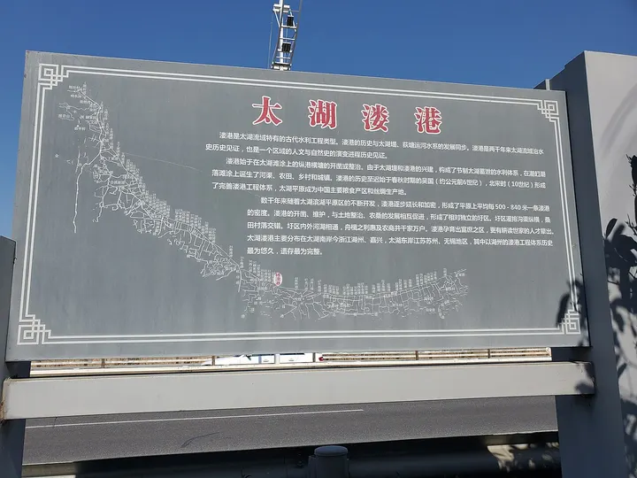
The lougang are hundreds of small channels and larger waterways cut from the Spring and Autumn period onward through the southern shore of Taihu Lake, which with cross-dykes and polder fields drained the land and regulated the lake; the network is best preserved in Wuxing and was listed as a World Heritage Irrigation Structure in 2016. Visits centre on Yigao, an old village strung along its channel near the lake, with stone bridges, a Lougang culture exhibition hall, cafés and guesthouses.
How to get to Taihu Lougang Waterways (Yigao)
In Zhili town on the Taihu shore, about 20 km north-east of central Huzhou, roughly 30 minutes by road.
Nearby
- Wuzhen Water Town 乌镇 30 km
Stone bridges and lantern-lit canals in a water town that's best after dark - Classical Gardens of Suzhou 苏州园林 50 km
Whole landscapes of rock, water and pavilion folded into a city block - Zhouzhuang 周庄古镇 60 km
Jiangnan's most famous water town, famed for its Twin Bridges and merchant halls
Also within 20 km: Dongmiao Bridge 东庙桥 (under 10 km), Huzhou Silk Town (Xishanyang) 湖州丝绸小镇 (10 km), Nanxun Ancient Town 南浔古镇 (20 km), Dongshan Ming Residences (Mingshan Hall) 东山民居 (20 km), Xuanyuan Temple, Dongshan 轩辕宫 (20 km), Three Bridges of Shuanglin 双林三桥 (20 km).
On the map
Open Taihu Lougang Waterways (Yigao) on the illustrated map to see the terrain around it and what else is close, and to add it to a trip.
Open Taihu Lougang Waterways (Yigao) on the map