 Atlas of China
Chinese Workers' and Peasants' Red Army School Site, Ruijin 瑞金中央工农红军学校旧址Ruìjīn Zhōngyāng Gōngnóng Hóngjūn Xuéxiào Jiùzhǐ
National heritage site · Ganzhou, Jiangxi
- Time needed
- 1 hour
- Days to budget
- Half a day
- City
- Ganzhou
- Region
- Jiangxi
- Type
- Heritage
- Listed as
- National heritage site
About Chinese Workers' and Peasants' Red Army School Site, Ruijin
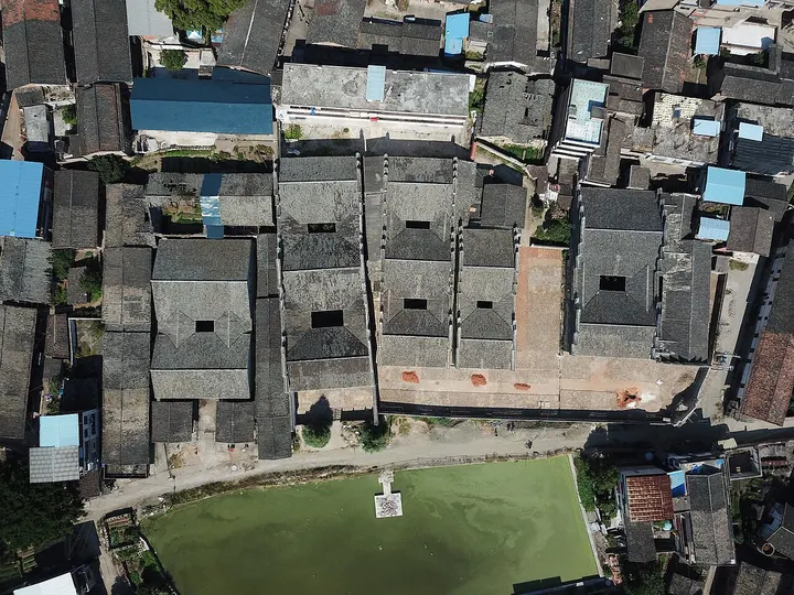
Five adjoining Yang-clan ancestral halls in Shangyang, in Ruijin's old town, housed the Red Army's officer school in the early 1930s, one hall for each department: general affairs, political work, school affairs, instruction and the club. The brick-and-timber halls were built between 1608 and 1921 and cover about 6,100 square metres. The school ran six courses and trained more than 11,500 cadres under principals who included Liu Bocheng and Ye Jianying, before it was reorganised into the Red Army University and other schools in October 1933.
How to get to Chinese Workers' and Peasants' Red Army School Site, Ruijin
In the Shangyang neighbourhood of Xianghu, Ruijin's urban town, about 3 km east-south-east of the Red Well zone of the Cradle of the Republic scenic area. Check that it is open before going.
Nearby
Also within 20 km: Ruijin Cradle of the Republic Scenic Area 瑞金共和国摇篮景区 (under 10 km), Yangxi Sites: Central Military Commission and Marxism-Communism School 中革军委旧址与马克思共产主义学校旧址 (under 10 km), Yuxue Ruijing Scenic Area 浴血瑞京 (under 10 km).
On the map
Open Chinese Workers' and Peasants' Red Army School Site, Ruijin on the illustrated map to see the terrain around it and what else is close, and to add it to a trip.
Open Chinese Workers' and Peasants' Red Army School Site, Ruijin on the map