 Atlas of China
Yiwulü Mountain 医巫闾山Yīwūlǘ Shān
4A scenic area · Jinzhou, Liaoning
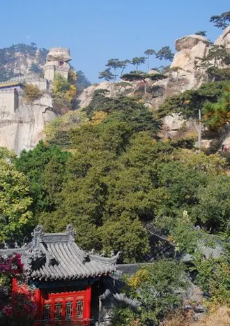
About Yiwulü Mountain
A mountain range some 45 km long on the western edge of Beizhen, revered since ancient times as the guardian mountain of the north and, under the Liao dynasty, an imperial hunting ground; its highest peak, Wanghai Peak, is about 870 m. The Beizhen scenic area has forest walks, an old stand of black pine and temples such as the Guanyin Pavilion. Other parts of the range, such as Daluhua and Qingyan Temple, are separate scenic areas with their own entries.
How to get to Yiwulü Mountain
About 6 km west of Beizhen town and about 74 km north-east of central Jinzhou.
Nearby
Also within 20 km: Dachaoyang Hot Spring Resort, Beizhen 大朝阳温泉山城 (under 10 km), Beizhen Temple 北镇庙 (under 10 km), Guangning City, Beizhen (Drum Tower and Li Chengliang Arch) 广宁城(鼓楼与李成梁石坊) (under 10 km), Twin Pagodas of Chongxing Temple 崇兴寺双塔 (under 10 km), Daluhua, Yiwulü Mountain 医巫闾山大芦花 (10 km), Qingyan Temple, Beizhen 青岩寺 (20 km).
On the map
Open Yiwulü Mountain on the illustrated map to see the terrain around it and what else is close, and to add it to a trip.
Open Yiwulü Mountain on the map