 Atlas of China
Changji 昌吉Chāngjí
Heavenly Lake, rolling wheat hills and the ruins of Beiting
- Type
- Hui Autonomous Prefecture
- Region
- Xinjiang
- Featured places
- 1
- Listed sites
- 151 rated 5A · 9 rated 4A · 7 national heritage
About Changji
Changji Hui Autonomous Prefecture wraps around Ürümqi on both sides, running from the snows of the Bogda range north into the Junggar Basin, and Hui Muslims are its largest minority. Heavenly Lake, an alpine lake below Bogda Peak, is its best-known sight, while the dry-farmed wheat of Jiangbulak rolls across the foothills near Qitai. At Jimsar stand the earthen walls of Beiting, seat of the Tang Beiting Protectorate and later a summer capital of the Uyghur Qocho kingdom.
Featured places in Changji
-
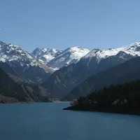
Heavenly Lake of Tianshan 天山天池
An alpine lake beneath snowy Bogda Peak, a day trip from Ürümqi
Listed sites in Changji
15 sites in Changji are on the official lists. Those with a page of their own link to it; the rest open as cards on the map.
- Jiangbulak Scenic Area 江布拉克 5A scenic area · National heritage site · on the map
A 48 km² mountain scenic area on the northern slopes of the Tianshan south of Qitai, known for the dry-farmed wheat fields that roll across the hills below forest and snow peaks. - Beiting Ancient City (Beshbalik) 北庭故城遗址 4A scenic area · National heritage site
The earthen ruins of Beiting (Beshbalik), seat of the Tang Beiting Protectorate and later the summer capital of the Uyghur kingdom of Qocho, which was the leading city on the northern side of the Tianshan for some 700 years until its destruction in the 15th century. - Century Park, Hutubi 世纪园 4A scenic area · on the map
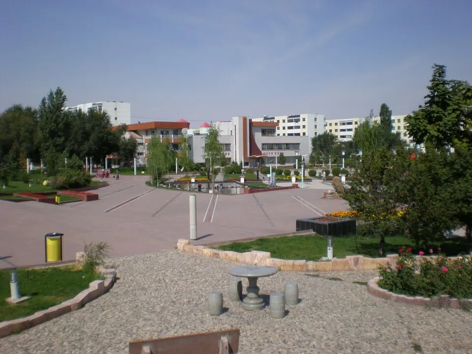
A large landscaped public park in Hutubi county town, used by local people for walks and for festivals such as the Lantern Festival light displays. - Dushi Tourism Resort 杜氏旅游 4A scenic area · on the map
A leisure resort north-east of Changji city that grew from a farm guesthouse opened in 1997 into a large complex of orchards, amusement rides, a water park and restaurants. - Huaxing Youyou Valley 华兴悠游谷 4A scenic area · on the map
A leisure park in the Changji National Agricultural Science and Technology Park north of Changji city, combining a winery, a small animal park, flower nurseries and an outdoor activity camp. - Manas National Wetland Park (Yanfeitai) 玛纳斯国家湿地公园 4A scenic area · on the map
A national wetland park formed by the Manas and Taxi rivers and the reservoirs and canals between them, piloted from 2011 and formally designated in 2016. - Qianfodong Temple, Jimsar 吉木萨尔千佛洞 4A scenic area · on the map
A Buddhist temple and cave shrine near Jimsar town, rebuilt in the Qing dynasty and restored since 1993, now set in a temple park with halls to Kshitigarbha and Guanyin and a main Buddha hall. - Tingzhou Ecological Green Valley 庭州生态绿谷 4A scenic area · on the map
A riverside park about 13 km long on the Toutun River at the boundary between Changji and Ürümqi, created by a five-year clean-up, completed in 2021, of a valley once scarred by gravel pits and workshops. - Xinjiang Agricultural Expo Park 新疆农业博览园 4A scenic area · on the map
A large agricultural showground and garden at the core of the Changji National Agricultural Science and Technology Park, with exhibition areas, glasshouses of tropical plants and fruit, and fields for picking fruit and vegetables. - Zhonghua Biyu Yuan (Manas Jade Park) 中华碧玉园 4A scenic area · on the map
A large commercial complex in Manas town built in the 2010s around the trade in Manas green jade (biyu), with a jade and stone market, shops, restaurants and a sports centre. - Beacon Towers of Changji 昌吉州境内烽燧群 National heritage site · on the map
A protected group of Tang to Qing beacon towers, Qing post stations and a stretch of Tang road along the northern route of the Silk Road through seven counties and county-level cities of Changji, from Manas in the west to Mori in the east. - Kangjiashimenzi Rock Carvings 康家石门子岩画 National heritage site · on the map
A Bronze Age rock-carving panel under an overhang of a south-facing red cliff in the danxia hills of south-western Hutubi County, with hundreds of carved human and animal figures. - Manas Ancient City Ruins 玛纳斯古城遗址 National heritage site · on the map
The earthen walls of a Tang-dynasty garrison town, locally called Pochengzi, on the plain north-east of Manas town; it is the westernmost Tang city site on the northern foot of the Tianshan and stayed in use until about the Western Liao or Yuan period. - Tangchaodun Ancient City 唐朝墩古城遗址 National heritage site · on the map
The ruins of Pulei, a county town founded under the Tang in 640 and used by the Uyghur kingdom of Qocho, the Western Liao and the Mongols until it was abandoned in the 15th century, now on the north-eastern edge of Qitai town. - Xiaolizhuang Military Reclamation Site 小李庄军垦旧址 National heritage site · on the map
The former headquarters of a Bingtuan farming division, built from 1953 by army land-reclamation units on the east bank of the Manas River as a complex of Soviet-style farm buildings, including offices and a large assembly hall.
On the map
Open Changji on the illustrated map to see its outline, its places and listed sites together, and to add them to a trip.
Open Changji on the map