 Atlas of China
Yulin 榆林Yúlín
Great Wall watchtowers, a Xiongnu capital and a stone city 4,000 years old
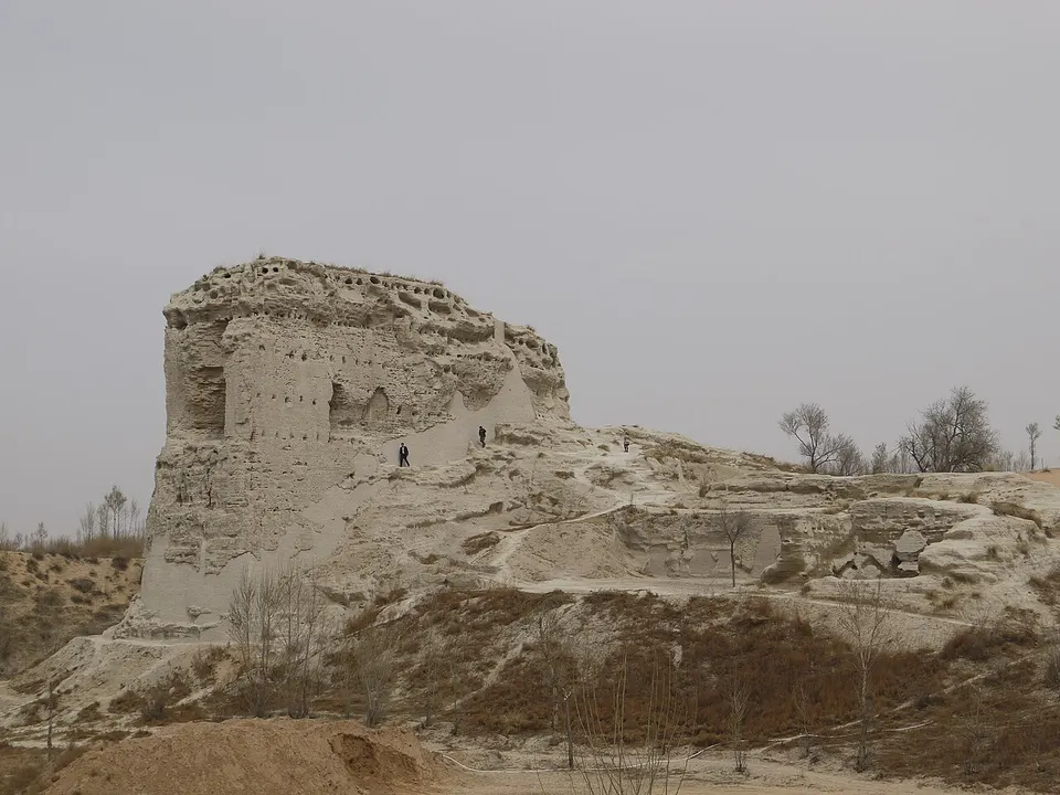
About Yulin
Yulin, Shaanxi's northernmost city, lies where the sands of the Mu Us Desert meet the loess hills, and under the Ming it was the headquarters of Yansui, one of the Nine Garrisons along the Great Wall. Its old town keeps a long main street passing under a row of towers, and just to the north stands the Ming watchtower of Zhenbeitai. Farther out are the pale walls of Tongwancheng, a 5th-century Xiongnu capital, and Shimao, a stone-walled city more than 4,000 years old.
What to eat in Yulin
- Yulin pinsanxian (榆林拼三鲜)
- Mizhi braised donkey intestine (米脂驴板肠)
- Suide layered youxuan pastries (绥德千层油旋)
Featured places in Yulin
-
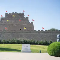
Yulin Old Town and Zhenbeitai 榆林古城·镇北台
A four-tier Ming watchtower on the Great Wall and an old garrison street under six towers
-
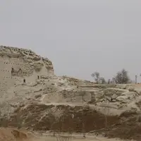
Tongwancheng Ruins 统万城遗址
Pale rammed-earth walls of a 5th-century Xiongnu capital at the edge of the Mu Us Desert
Listed sites in Yulin
28 sites in Yulin are on the official lists. Those with a page of their own link to it; the rest open as cards on the map.
- Baiyun Mountain Temples, Jiaxian 白云山 4A scenic area · National heritage site · on the map
A large Taoist temple complex on Baiyun Mountain above the west bank of the Yellow River just south of Jia County town, founded in 1605 and rebuilt and enlarged in 1724. - Bilinwan Resort 碧麟湾 4A scenic area · on the map
A modern four-season resort south of Shenmu city, with a water park and amusement rides for the summer season. - Boluo Fortress 波罗古堡 4A scenic area · on the map
A walled hilltop garrison town on Huangyun Hill above the south bank of the Wuding River, one of the forts of the Ming-dynasty Great Wall frontier in the Yulin region, with stone walls and four gates around an old main street; it is protected as a provincial heritage site. - Bulanghe Women's Militia Sand-Control Company 补浪河女子民兵治沙连 4A scenic area · on the map
In 1974, 54 young women with an average age of 18 formed a militia company at Bulanghe to plant trees and fix the dunes of the Mu Us sands near the Inner Mongolia border, and the unit became known across China. - Chiniuwa Folk Culture Village 赤牛坬村 4A scenic area · on the map
A hill village of old stone cave dwellings among jujube groves near the Yellow River, which its residents have turned into a folk-culture tourist village. - Erlang Mountain, Shenmu 二郎山 4A scenic area · on the map
A temple-covered ridge on the west bank of the Kuye River facing central Shenmu, also called Bijia ('brush-rest') Mountain because the Ming emperor Wuzong is said to have likened its outline to one in 1518. - Erlintu Grassland 尔林兔大草原 4A scenic area · on the map
A grassland scenic area in Erlintu township on the sandy steppe at the edge of the Mu Us Desert, run as a farm-and-grassland leisure park with open pasture, flower fields and a children's play park. - Haojiaqiao Village 郝家桥 4A scenic area · on the map
A loess-hill village south-west of Suide that the Shaanxi–Gansu–Ningxia Border Region government named a 'model village' in 1944, when the labour hero Liu Yuhou led its farmers' labour-exchange teams in the wartime production drive. - Heilongtan (Black Dragon Pool), Zhenchuan 黑龙潭 4A scenic area · on the map
A hillside temple to the Black Dragon King above a group of spring-fed pools beside the Wuding River at Zhenchuan, founded in the Ming Zhengde period (1506–1521) and long visited by farmers praying for rain. - Hongjiannao Lake 红碱淖 4A scenic area
Regarded as China's largest desert freshwater lake, Hongjiannao now covers about 37 km² where the loess plateau meets the Mu Us Desert on the border with Inner Mongolia. - Mahuangliang Loess Geopark 麻黄梁黄土地质公园 4A scenic area · on the map
A 37 km² geopark on the loess plateau east of Yulin, where deep gullies have cut the thick loess into a 'peak forest' of pillars and ridges and exposed sections of Quaternary sediment, with desert landforms and fossil finds nearby. - Mingzhou Old Town, Suide 名州古城 4A scenic area · on the map
The historic core of Suide town, run as a cultural tourism district that links the Mingzhou historic street with the Suide Revolutionary Memorial Hall, a museum of Han-dynasty carved stone reliefs and the Fusu Culture Garden around the tomb on Shushu Hill traditionally attributed to Fusu, eldest son of the First Emperor of Qin. - Northern Scenery (Beiguo Fengguang) Scenic Area 北国风光 4A scenic area · on the map
A red-tourism scenic area on the Gaojiawa plateau above the Yellow River, named after the opening words of Mao Zedong's poem 'Snow' (Qinyuanchun · Xue). - Northern Shaanxi Folk Song Museum 陕北民歌博物馆 4A scenic area · on the map
A museum devoted to the folk songs of northern Shaanxi, with about 5,700 m² of displays on traditional songs, the revolutionary songs of the Yan'an years such as 'The East Is Red', newer compositions and the region's folk music. - Shengdu Amusement Park 圣都乐园 4A scenic area · on the map
An open-plan amusement park inside the Yuxi riverside park in central Yulin, opened in October 2014. - Shimao 石峁遗址 4A scenic area · National heritage site
The ruins of a stone-walled city built around 2300 BC and abandoned around 1800 BC, the largest known walled settlement of China's late Neolithic, with inner and outer stone walls enclosing more than 400 ha around a terraced palace platform called Huangchengtai. - Wave Valley, Jingbian 波浪谷 4A scenic area · on the map
A Danxia landscape of eroded red sandstone in the gullies at Longzhou, south-east of Jingbian town, named for the wave-like layering of its rock. - Yangjiagou Revolutionary Site 杨家沟革命旧址 4A scenic area · National heritage site · on the map
From November 1947 the CPC Central Committee's front committee under Mao Zedong, Zhou Enlai and Ren Bishi, together with the PLA headquarters, spent 120 days in this loess-valley village during the civil war, and held an enlarged Central Committee meeting here on 25–28 December 1947, known as the December Meeting. - Yellow River Eastward Crossing Site, Wubu 黄河东渡 4A scenic area · on the map
A Yellow River scenic area north of Wubu town that links three sites: the Erqi rapids, opposite Qikou in Shanxi, where the narrowed river pours over rock ledges; the old Guaishang ferry, with rafting on the river; and the memorial park at the Chuankou ferry, where Mao Zedong crossed into Shanxi on 23 March 1948, leaving northern Shaanxi after 13 years. - Dang Family Manor, Suide 党氏庄园 National heritage site · on the map
A hillside manor of cave-dwelling courtyards at Hejiashi village, begun in 1814 and enlarged by six generations of the Dang family until the Republican period, stepped up the slope and decorated with stone, brick and wood carving. - Fuzhou Ancient City, Fugu 府州古城 National heritage site
A walled hill town above the Yellow River at Fugu, the seat of Fuzhou prefecture from 911, whose stone walls date from the Five Dynasties and Song. - Hongmen Temple Pagoda 鸿门寺塔 National heritage site · on the map
An eleven-storey octagonal brick pagoda about 27 m tall, built in the Taiding era of the Yuan dynasty (1324–1328) at the Hongmen Temple south-west of Tawan town; the temple itself has long gone. - Jiang Family Manor 姜氏庄园 National heritage site · on the map
A fortified cave-dwelling manor built for the Jiang family in the late Qing, with lower, middle and upper courtyards climbing a hillside behind crenellated stockade walls and gun platforms. - Li Zicheng's Palace, Mizhi 李自成行宫 National heritage site · on the map
A hillside group of Ming and Qing buildings on the southern slope of Panlong Mountain at the north end of Mizhi town, which local tradition links to Li Zicheng, the Mizhi rebel leader who overthrew the Ming dynasty in 1644, as his palace, and which also served as a temple of the Taoist god Zhenwu. - Linzhou Ancient City (Yangjiacheng) 麟州故城 National heritage site · on the map
The earthen ruins of Linzhou, a frontier prefectural city of the Tang to Ming dynasties on Yangcheng Hill north of Shenmu, known locally as Yangjiacheng ('Yang family city') because the family of the Northern Song general Yang Ye held it. - Qixing Temple, Fugu 七星庙 National heritage site · on the map
A small Ming-dynasty temple, also called the Haotian Palace, on a hilltop about 1 km north of the old Gushan fort town in Fugu county. - Site of the Xiaohe Meeting 小河会议旧址 National heritage site · on the map
The village where the CPC Central Committee under Mao Zedong and the PLA headquarters stayed for 48 days in summer 1947 while moving around northern Shaanxi during the civil war, and where an enlarged Central Committee meeting on 21–23 July 1947, held under a shelter in a villager's courtyard, decided the PLA's shift from strategic defence to the offensive. - Wubu Stone City 吴堡石城 National heritage site · on the map
The former county town of Wubu, a stone-walled town on a hilltop above the west bank of the Yellow River, first built in the Northern Han period of the tenth century and still holding Ming and Qing buildings.
On the map
Open Yulin on the illustrated map to see its outline, its places and listed sites together, and to add them to a trip.
Open Yulin on the map