 Atlas of China
Guyuan 固原Gùyuán
Buddhist caves in red sandstone and Persian glass from Silk Road tombs
About Guyuan
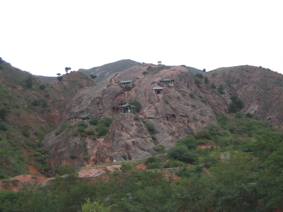
Guyuan sits high in the loess hills of southern Ningxia, cool in summer and split by the forested Liupan Mountains, the last high range the Central Red Army crossed on the Long March. Founded in 114 BC, the town later stood on the northern Silk Road, and Guyuan Museum shows a Sasanian glass bowl and gilt silver ewer from a local tomb. North-west of town, the Xumishan Grottoes hold more than 130 caves, among them a seated Tang Buddha about 20 metres tall.
What to eat in Guyuan
- Longde nuanguo hotpot (隆德暖锅)
- Jingyuan steamed chicken (泾源蒸鸡)
Listed sites in Guyuan
8 sites in Guyuan are on the official lists. Those with a page of their own link to it; the rest open as cards on the map.
- Liupan Mountain Long March Memorial 六盘山红军长征纪念馆 5A scenic area · on the map
A memorial complex on the pass over the Liupan Mountains, the last high range the Red Army crossed on the Long March in October 1935, a crossing Mao Zedong marked in his poem 'Mount Liupan'. - Guyuan Museum 固原博物馆 4A scenic area · on the map
A national first-grade museum, opened in 1988, with about 20,000 objects and best known for Silk Road finds from the Northern Dynasties, Sui and Tang tombs excavated around Guyuan. - Jiangtaibu Long March Meeting Site 将台堡红军长征会师纪念园 4A scenic area · National heritage site · on the map
The earthen fort where the Red Army's Second Front Army met the First Front Army on 22 October 1936, after the First and Fourth had met at Huining on 9 October; the meeting completed the union of the three main Red armies and is taken as the end of the Long March. - Liupan Mountain National Forest Park 六盘山国家森林公园 4A scenic area · on the map
A national forest park in the Liupan Mountains of southern Ningxia, whose main peak, Migang Shan, reaches 2,942 m; the damp slopes carry birch, poplar, oak and bamboo thickets that stand out from the dry Loess Plateau around them. - Xumishan Grottoes 须弥山石窟 4A scenic area · National heritage site
More than 130 Buddhist cave temples cut into the red sandstone hills of Mount Xumi from the late Northern Wei to the Tang dynasty, spread over about 1.5 km in groups such as Dafolou, Zisungong, Yuanguangsi, Xiangguosi and Taohuadong. - Daying Ancient City 大营城址 National heritage site · on the map
The rammed-earth walls of a frontier town built in the Song dynasty, when it was known as Yangmacheng ('horse-rearing town'), and used under the Ming from 1406 as a state horse-breeding station. - Guyuan Ancient City Walls 固原古城遗址 National heritage site · on the map
Surviving sections of the walls of Guyuan, founded in 114 BC as the seat of Anding commandery and rebuilt many times as a frontier stronghold; under the Ming it was one of the Nine Border Garrisons and seat of the governor-general of the three Shaanxi frontiers, and its outer wall was faced with brick in 1575. - Kaicheng Site (Palace of the Prince of Anxi) 开城遗址 National heritage site · on the map
Remains of the palace of Manggala, Prince of Anxi and third son of Kublai Khan, built from 1272 at Kaicheng in the northern Liupan Mountains and used as a Yuan imperial summer retreat until an earthquake wrecked it in 1306.
On the map
Open Guyuan on the illustrated map to see its outline, its places and listed sites together, and to add them to a trip.
Open Guyuan on the map