 Atlas of China
Beihai 北海Běihǎi
Silk Road tombs, treaty-port consulates and a volcanic island offshore
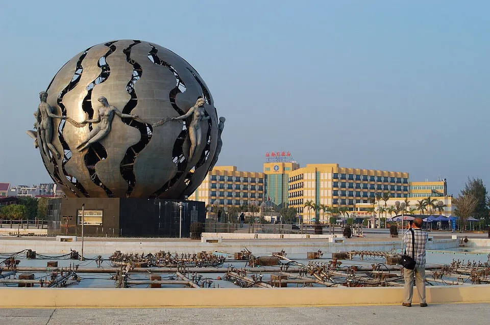
About Beihai
Beihai looks out over the Beibu Gulf from a peninsula, and Hepu County, on its northern side, was a Han-dynasty starting port of the Maritime Silk Road, whose tombs have yielded a Roman glass bowl and a Persian jar. Consulates and a customs house from Beihai's treaty-port days line the Impression 1876 Historic Quarter, and Silver Beach runs for some 24 km of fine white sand. Ferries cross to Weizhou Island, a volcanic island of sea cliffs, coral, Hakka villages and a Gothic church.
What to eat in Beihai
- Qiaogang Vietnamese-style rice rolls (侨港卷粉)
Listed sites in Beihai
18 sites in Beihai are on the official lists. Those with a page of their own link to it; the rest open as cards on the map.
- Weizhou Island (Nanwan & Crocodile Hill) 涠洲岛南湾鳄鱼山 5A scenic area · on the map
A volcanic island of about 25 km² in the Beibu Gulf, with lava coasts, sea cliffs and fringing coral, described as China's largest and geologically youngest volcanic island and protected as a national geopark since 2004. - Beihai Garden Expo Park 北海园博园 4A scenic area · on the map
A large landscaped park built as the venue of the fourth Guangxi Garden and Horticulture Expo, with themed display gardens laid out across the grounds. - Beihai Ocean Window 北海海洋之窗 4A scenic area · on the map
A modern marine-themed exhibition centre in the south of Beihai city, with aquarium tanks, themed halls on ocean life and interactive science displays. - Beihai Old Town (Zhuhai Road Old Street) 北海老城 4A scenic area · on the map
Beihai's old commercial quarter near the northern shore, where Zhuhai Road, Shaji Street and Zhongshan Road form a nationally listed historic block of shophouses with Western-style facades from the treaty-port years. - Beihai Silver Beach 北海银滩 4A scenic area
Beihai's main beach, a strand of fine white quartz sand running about 24 km along the south shore of the peninsula from Qiaogang to Daguansha, with a very gentle slope into the sea. - Beihai Underwater World 北海海底世界 4A scenic area · on the map
An aquarium on Chating Road in central Beihai, with tanks of marine fish, sharks and other sea life. - Gaode Old Town 高德古镇 4A scenic area · on the map
The historic core of Gaode, an old market town on the north-eastern edge of Beihai city that belonged to Hepu county until 1951, whose three old streets are protected by Guangxi as the Gaode Three Streets historic block. - Hepu Han Tombs Park & Han Dynasty Culture Museum 合浦汉墓群·汉代文化博物馆 4A scenic area · National heritage site · on the map
Hepu was a Han-dynasty starting port of the Maritime Silk Road, and in this heritage park on the edge of Lianzhou the grassy mounds across the lawns are barrows over 476 tombs of the Han to Wei–Jin period, with a visitor centre and an archaeology display area completed in 2021. - Hepu Mooncake Town 月饼小镇 4A scenic area · on the map
A mooncake-themed visitor complex at a baking factory in Lianzhou, built on Hepu's claim to the origin of filled cakes through a poem Su Dongpo wrote when he passed through the town. - Impression 1876 Historic Quarter (Beihai Treaty-Port Buildings) 印象·1876 4A scenic area · National heritage site · on the map
Central Beihai's group of Western-style buildings from the treaty-port era that followed the 1876 Chefoo Convention, spread over about 1 km around Beijing Road, Jiefang Road and Zhongshan East Road, among them the British consulate of 1885, the customs building of 1883 and the Qing post office of 1897. - Jinhaiwan Mangrove Forest 金海湾红树林 4A scenic area · on the map
A tract of coastal mangrove forest and tidal flats at Daguansha, east of Silver Beach, visited for its birds and the sea creatures of the mudflats. - Maritime Silk Road First Port (Haisi Shougang) 海丝首港 4A scenic area · on the map
A newly built Han-style harbour town at Yanlou village south-west of Lianzhou, themed on Hepu's role as a starting port of the Han-dynasty Maritime Silk Road. - Qiaogang Town 侨港小镇 4A scenic area · on the map
A small seaside town at the southern tip of Beihai, founded in 1979 as an overseas-Chinese fishing commune to resettle more than 7,700 ethnic Chinese who had left Vietnam. - Shengtang Catholic Church, Weizhou Island 涠洲岛圣堂 4A scenic area
A Gothic-style Catholic church in Shengtang village in the middle of Weizhou Island, built by missionaries of the Paris Foreign Missions Society and completed around 1880. - Xingdao Lake (Hongchaojiang Reservoir) 星岛湖 4A scenic area · on the map
A large reservoir in the hills of northern Hepu, built between 1959 and 1964 on the Hongchao River and named Xingdao ('star islands') Lake for the more than 1,000 islets scattered across its water. - Caoxiecun Site Park 草鞋村遗址 National heritage site · on the map
The excavated remains of a Han-dynasty town beside the Ximen River on the western edge of Lianzhou, which researchers working on Hepu's Maritime Silk Road heritage bid believe was the seat of the Hepu commandery. - Dashi Pavilion 大士阁 National heritage site · on the map
A Ming-dynasty timber pavilion at the centre of Yong'an, once one of the Ming coastal garrison posts, named after the bodhisattva Guanyin (Dashi) who is worshipped inside. - Hui'ai Bridge 惠爱桥 National heritage site · on the map
A Qing-dynasty bridge just outside the former west gate of Lianzhou, the old walled seat of Hepu, listed by Guangxi in 1994 and as a national heritage site in 2013.
On the map
Open Beihai on the illustrated map to see its outline, its places and listed sites together, and to add them to a trip.
Open Beihai on the map