 Atlas of China
Tung Lung Fort 东龙洲炮台Dōnglóngzhōu Pàotái
Declared monument · Hong Kong, Hong Kong
- Time needed
- Half a day
- Days to budget
- Half a day
- City
- Hong Kong
- Region
- Hong Kong
- Type
- Heritage
- Listed as
- Declared monument
About Tung Lung Fort
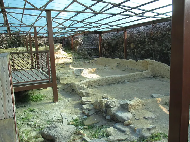
Tung Lung Fort sits on the north-eastern tip of Tung Lung Chau, a small island off the southern end of the Clear Water Bay Peninsula, looking over the Fat Tong Mun channel. It was built during the Kangxi reign (1662–1722) to guard against pirates and is a walled rectangle of about 33.5 by 22.5 metres, with fifteen guardhouses and eight cannons in its day. The garrison was moved to Kowloon Fort in 1810, and the ruins were partly restored in 1979–82, when excavations inside recovered a large quantity of artefacts.
How to get to Tung Lung Fort
On the north-eastern tip of Tung Lung Chau, about 0.8 km east of Tung Lung Chau Public Pier, which kaito ferries from Sam Ka Tsuen and from Sai Wan Ho serve on Saturdays, Sundays and public holidays only, according to the Transport Department.
Nearby
- Victoria Harbour 维多利亚港 10 km
Glass towers and green hills around a harbour you can cross in ten minutes - Victoria Peak 太平山顶 20 km
Ride the 1888 funicular to the skyline view, then walk the Lugard Road loop - Tian Tan Buddha & Ngong Ping 天坛大佛与昂坪 40 km
A giant bronze Buddha on Lantau, reached by a 25-minute cable car ride
Also within 20 km: Rock Carving on Tung Lung Chau 东龙洲石刻 (under 10 km), Tin Hau Temple, Joss House Bay 佛堂门天后古庙 (under 10 km), Rock Inscription at Joss House Bay 大庙湾刻石 (under 10 km), Siu Sai Wan Promenade 小西湾海滨花园 (under 10 km), Rock Carving at Big Wave Bay 大浪湾石刻 (under 10 km), Rock Carving at Lung Ha Wan 龙虾湾石刻 (under 10 km).
On the map
Open Tung Lung Fort on the illustrated map to see the terrain around it and what else is close, and to add it to a trip.
Open Tung Lung Fort on the map