 Atlas of China
Mount Jinfo 金佛山Jīnfó Shān
5A scenic area · Chongqing, Chongqing
- Time needed
- 1–2 days
- Days to budget
- 1½ days
- City
- Chongqing
- Region
- Chongqing
- Type
- Nature
- Listed as
- 5A scenic area
About Mount Jinfo
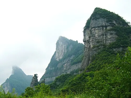
A flat-topped limestone massif in the Dalou Mountains, ringed by cliffs up to 300 m high and rising to over 2,200 m at Fengchuiling, which joined the South China Karst World Heritage Site in 2014. The plateau has forests, caves and karst landforms and an exceptional range of plants, with more than 4,700 seed-plant species, and it is a refuge for the rare François' langur. Cable cars from the north and west slopes reach the top, where there are ski slopes in winter.
How to get to Mount Jinfo
In Nanchuan District: the West Slope visitor centre is about 20 km by road south-east of Nanchuan town, which is about 2 hours by road from central Chongqing; buses run from Nanchuan bus station and Nanchuan North railway station.
Nearby
Also within 20 km: Shenlong Gorge 神龙峡 (under 10 km), Western Mushroom Valley 西部菌谷 (20 km).
On the map
Open Mount Jinfo on the illustrated map to see the terrain around it and what else is close, and to add it to a trip.
Open Mount Jinfo on the map